Top of the South Island, Aotearoa New Zealand
 |
 |
Postseismic deformation following the M7.8 Kaikōura earthquake:
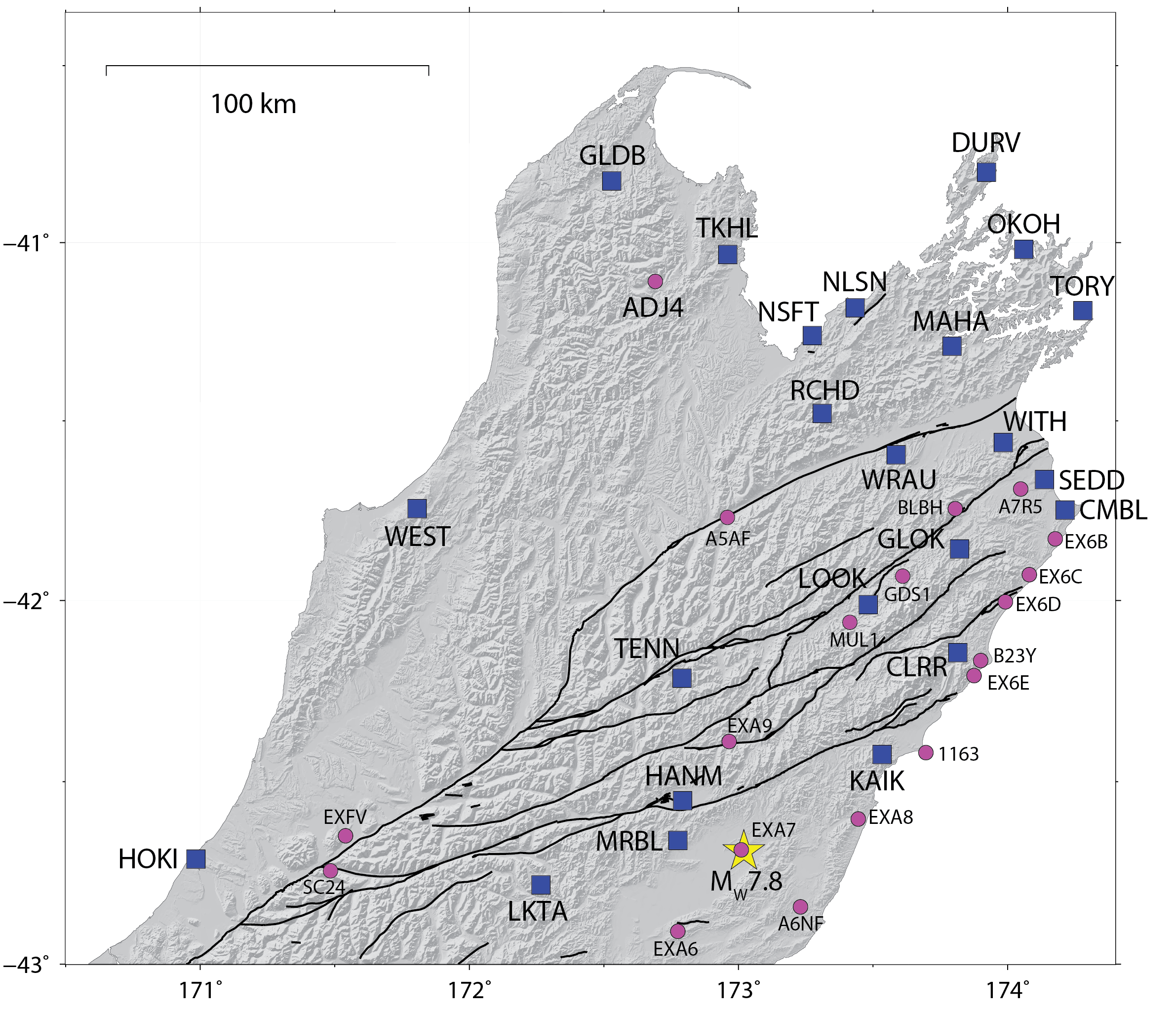
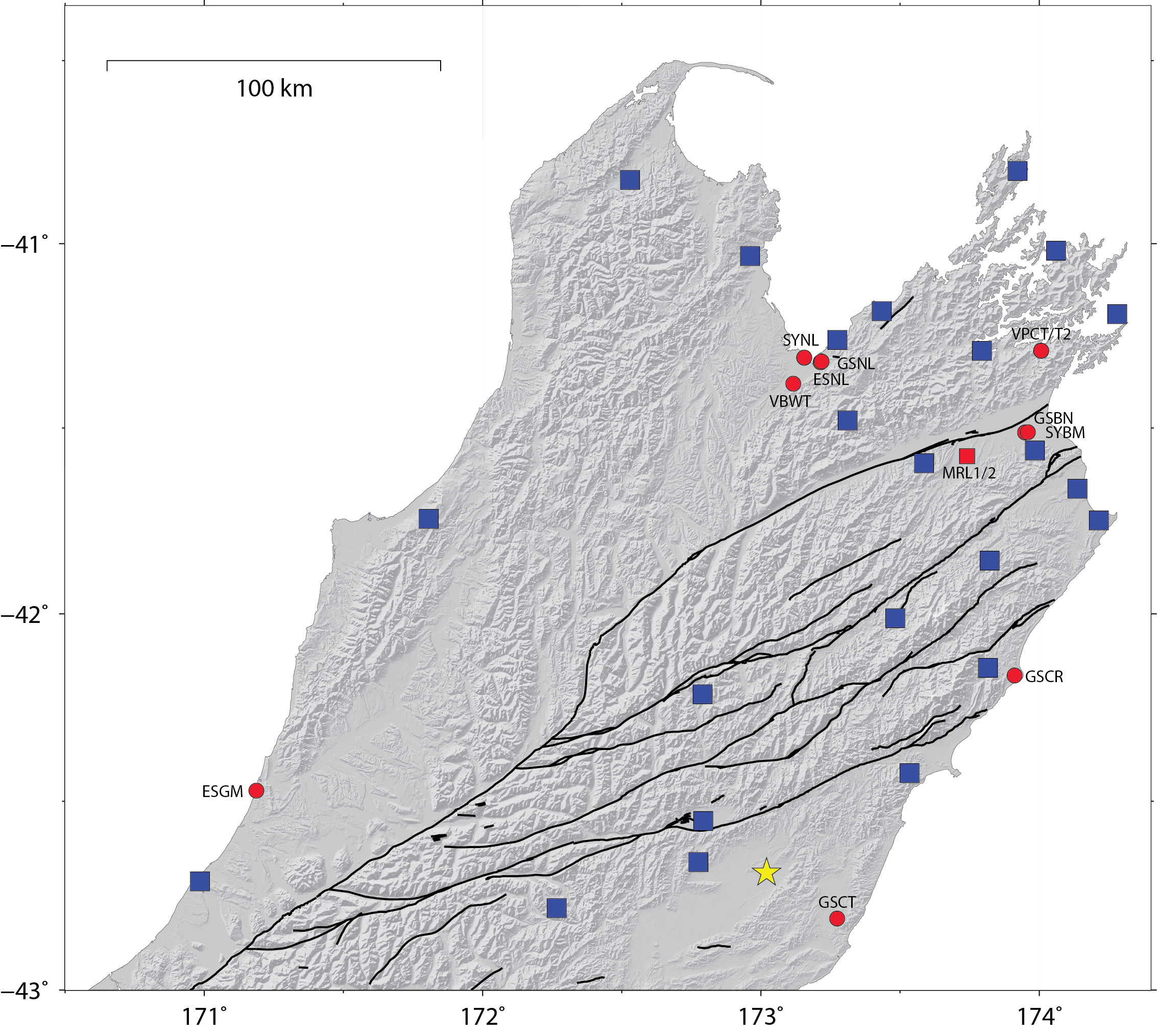
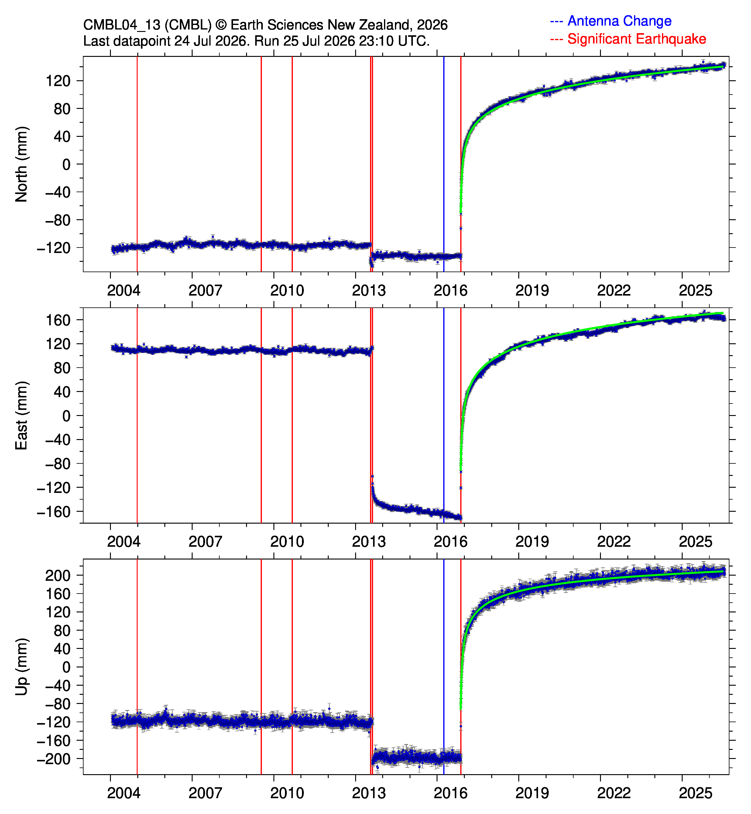
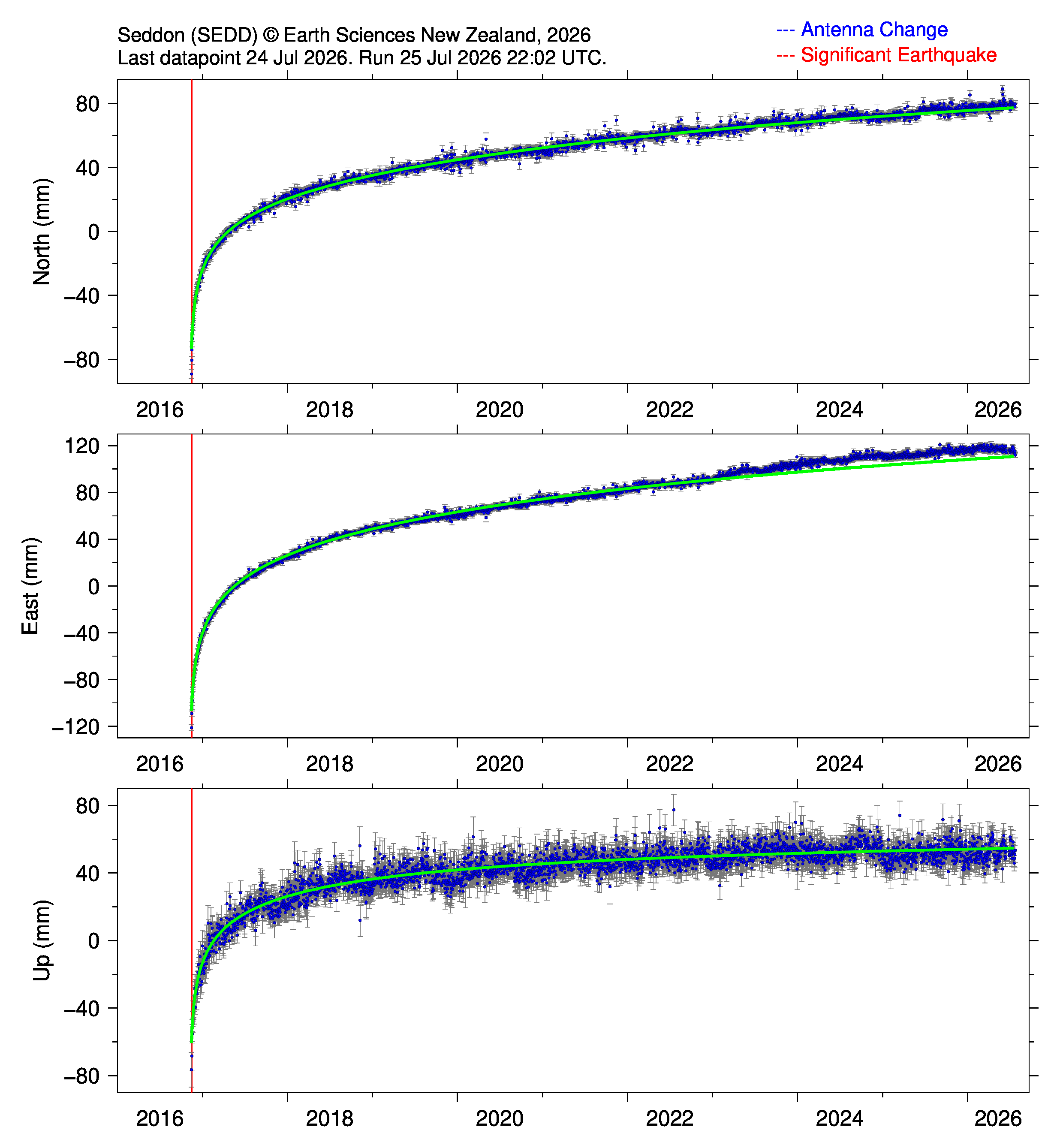
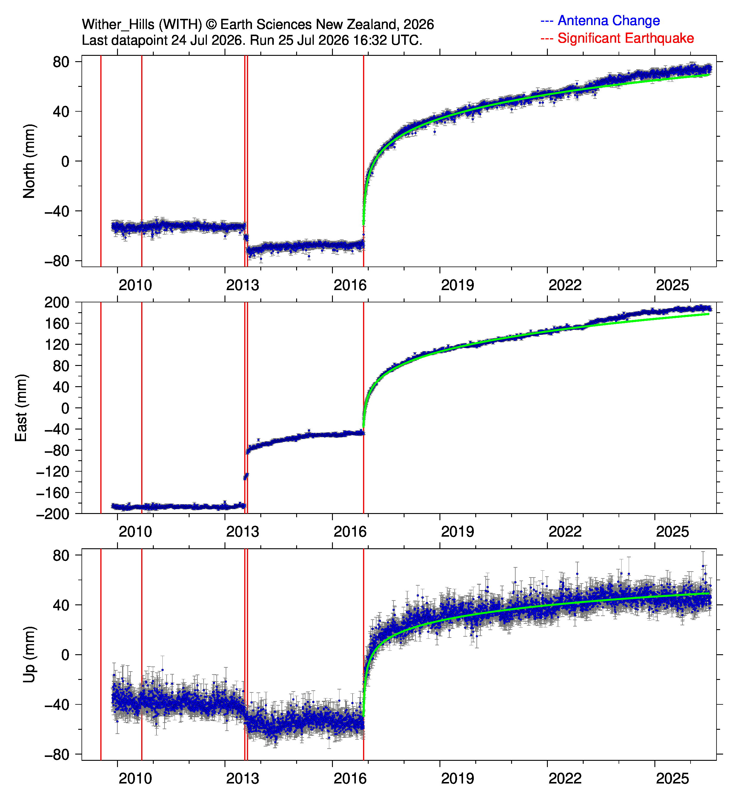
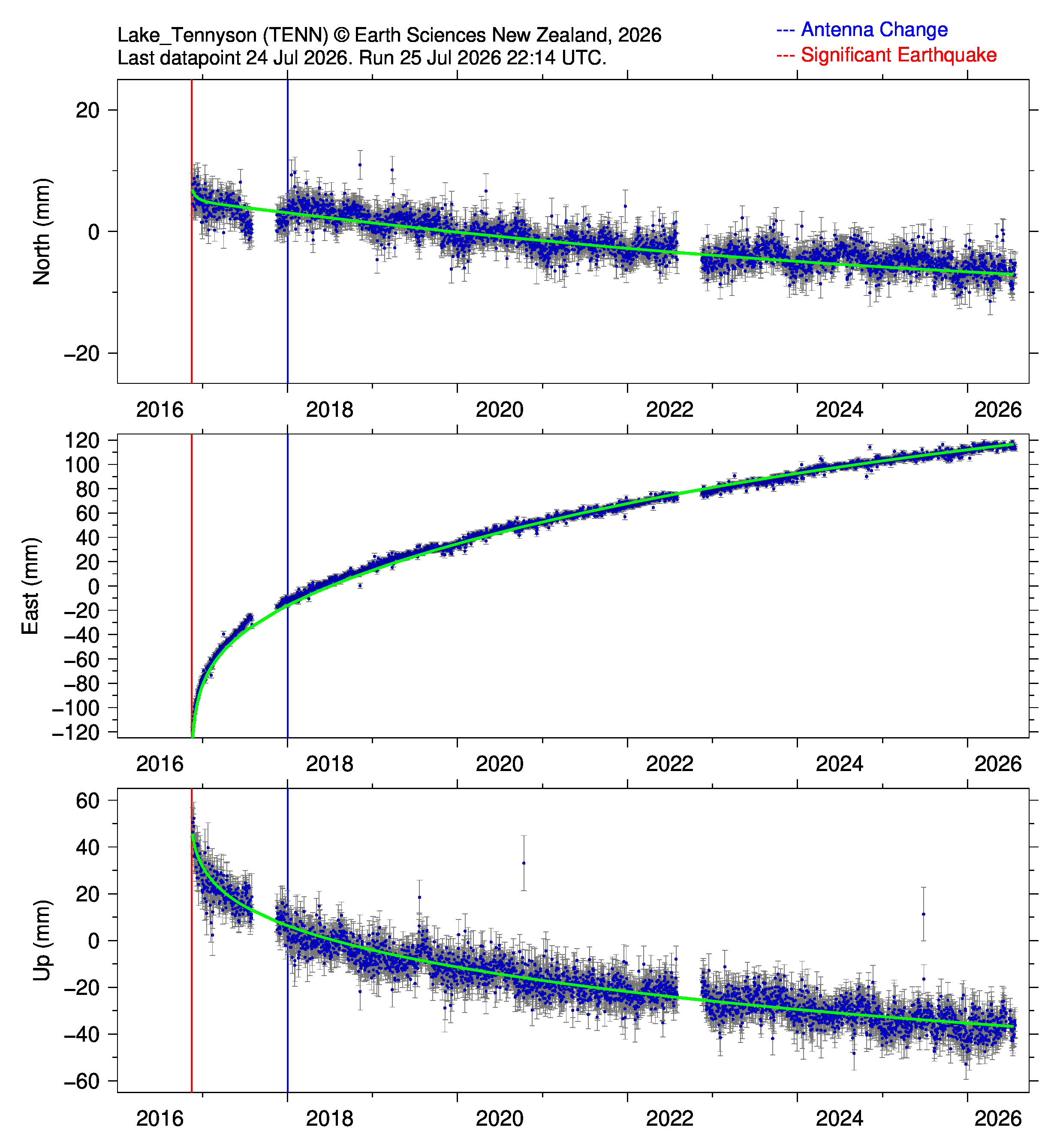
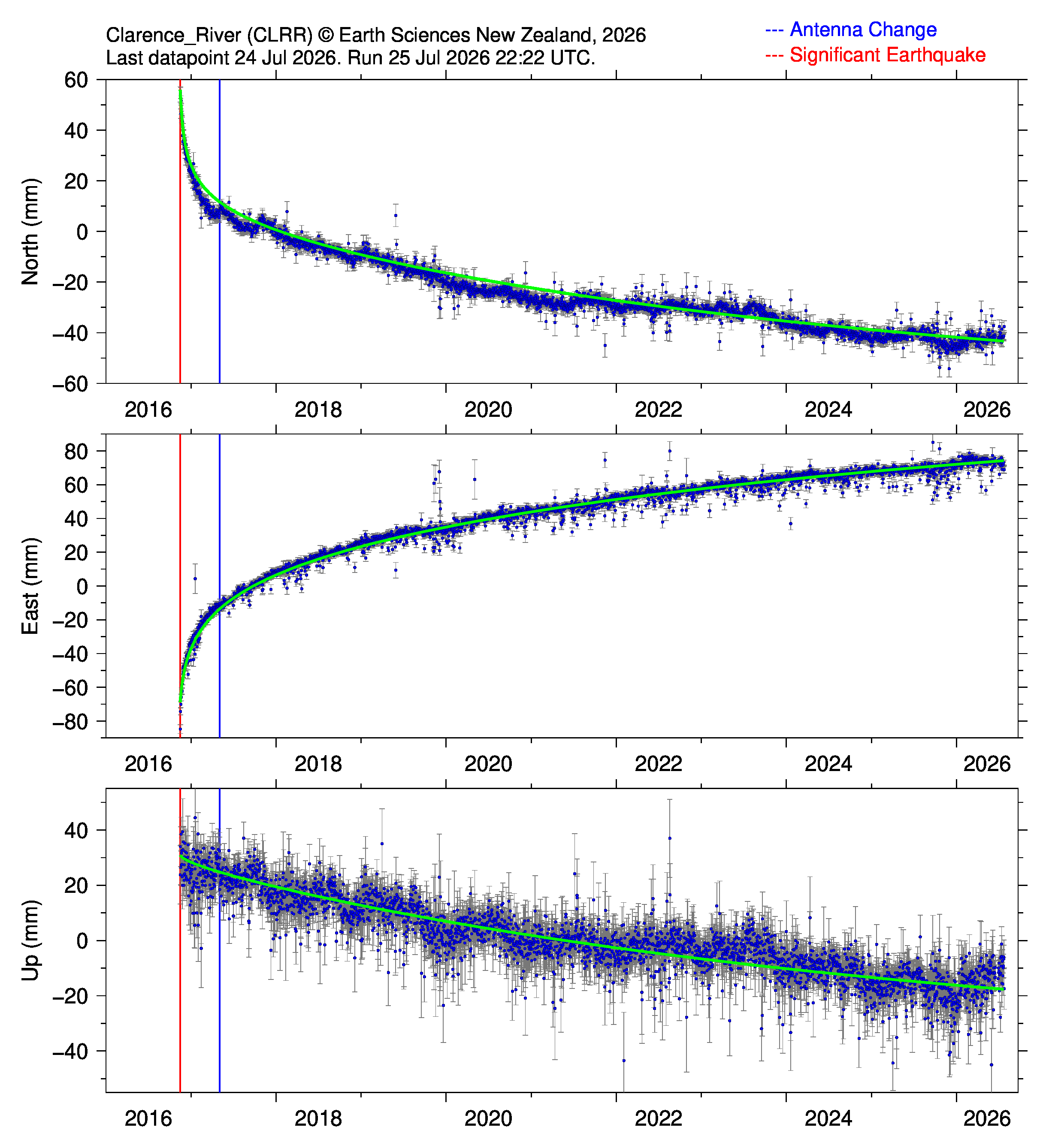
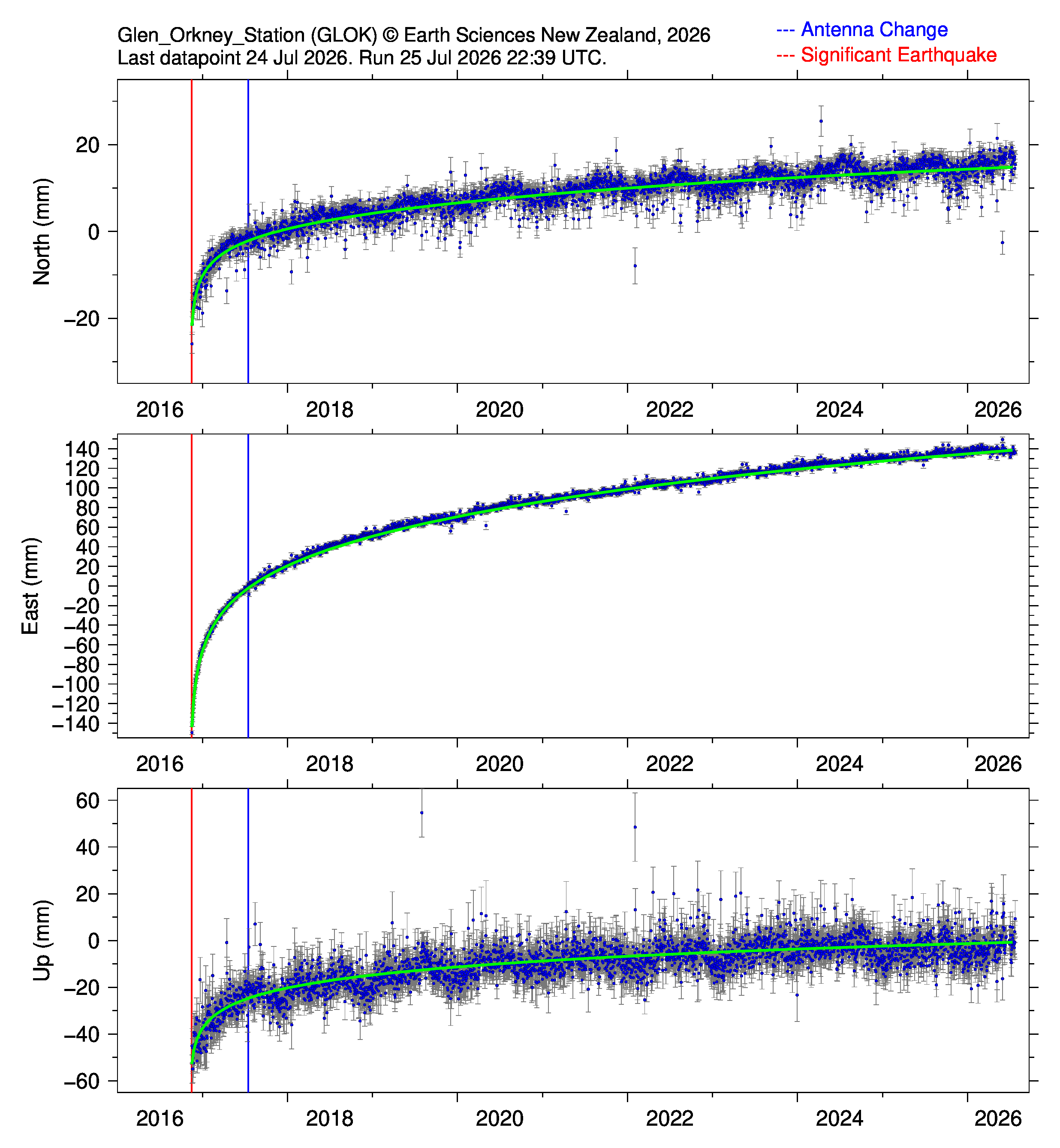
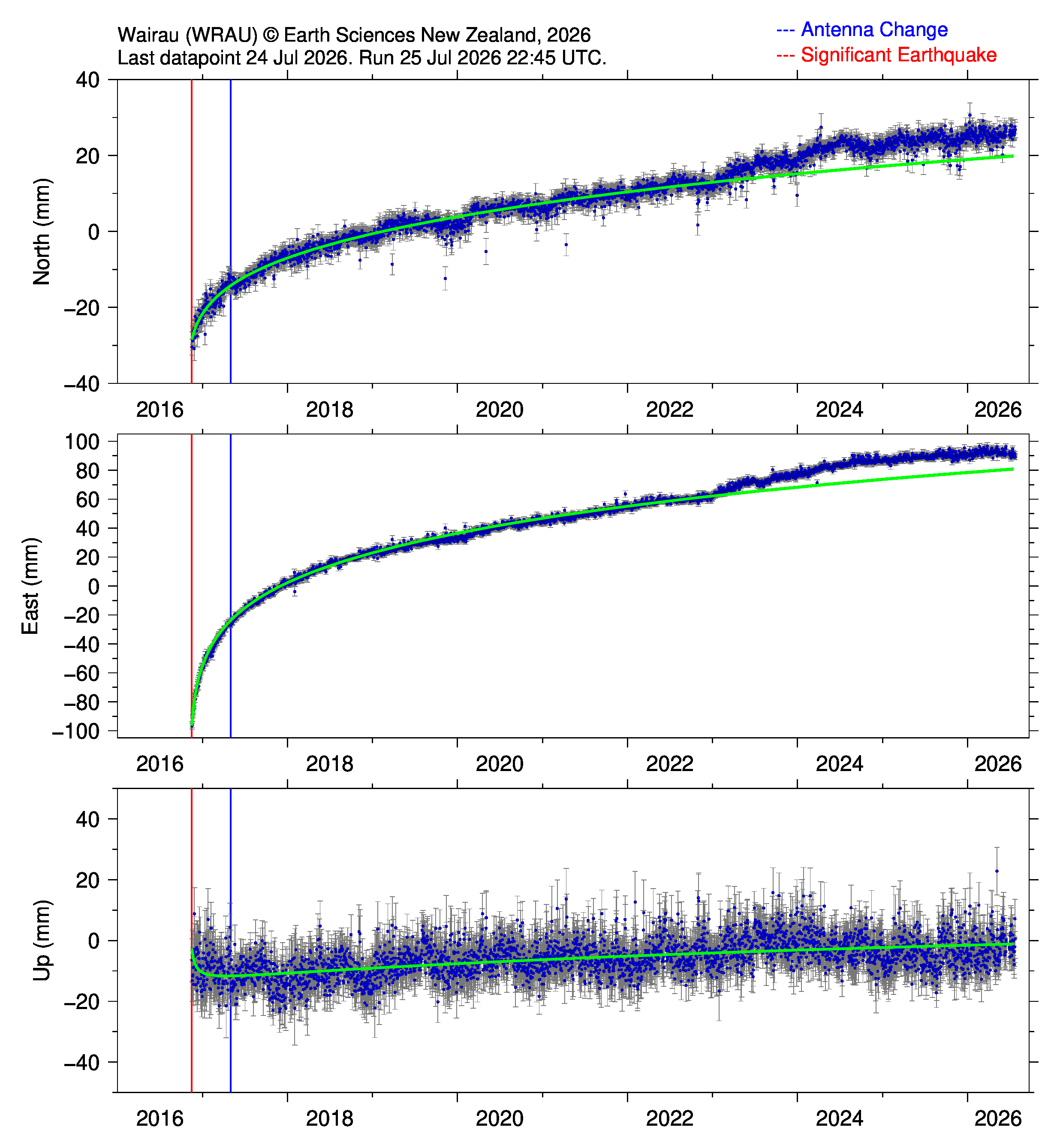
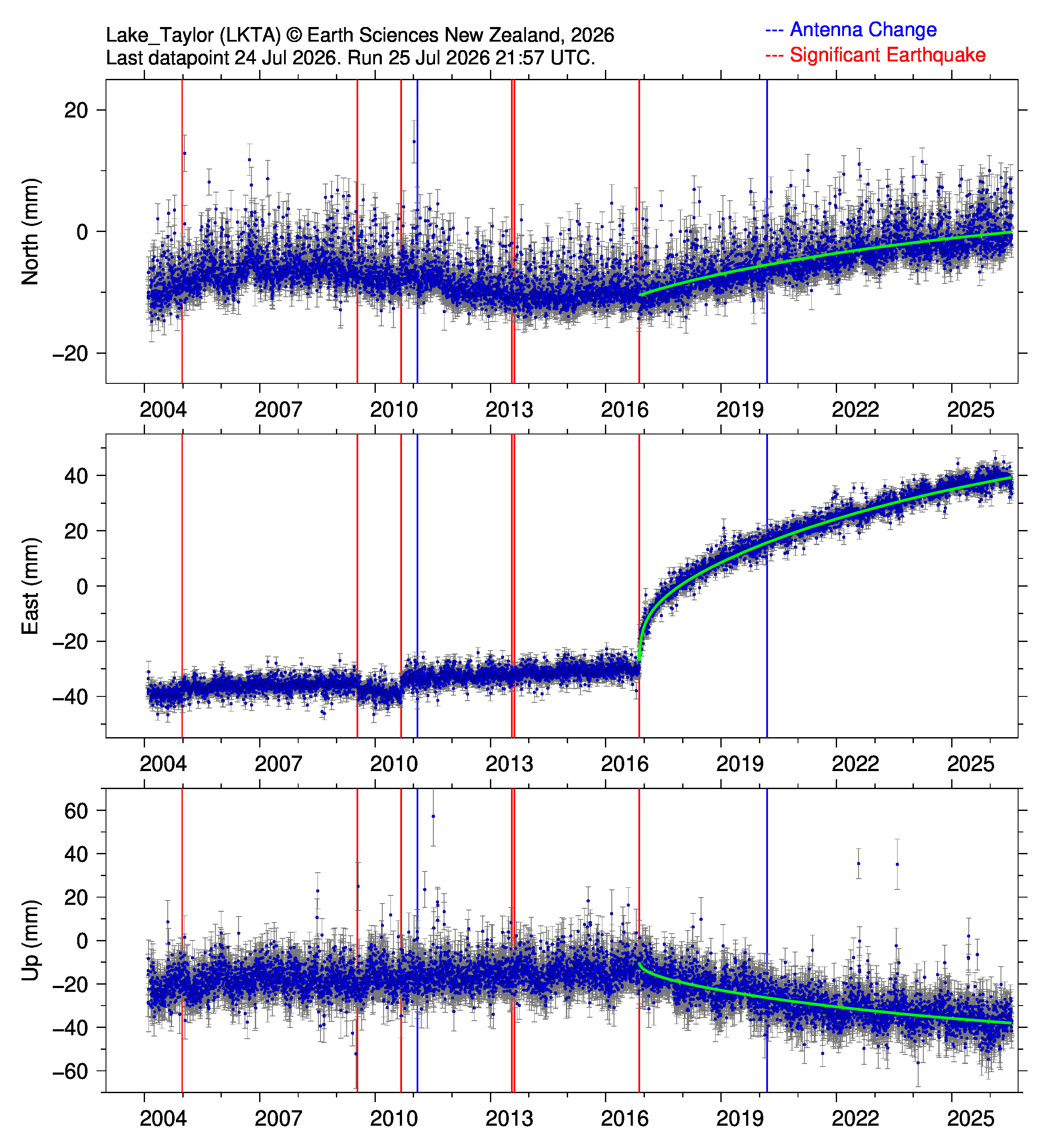
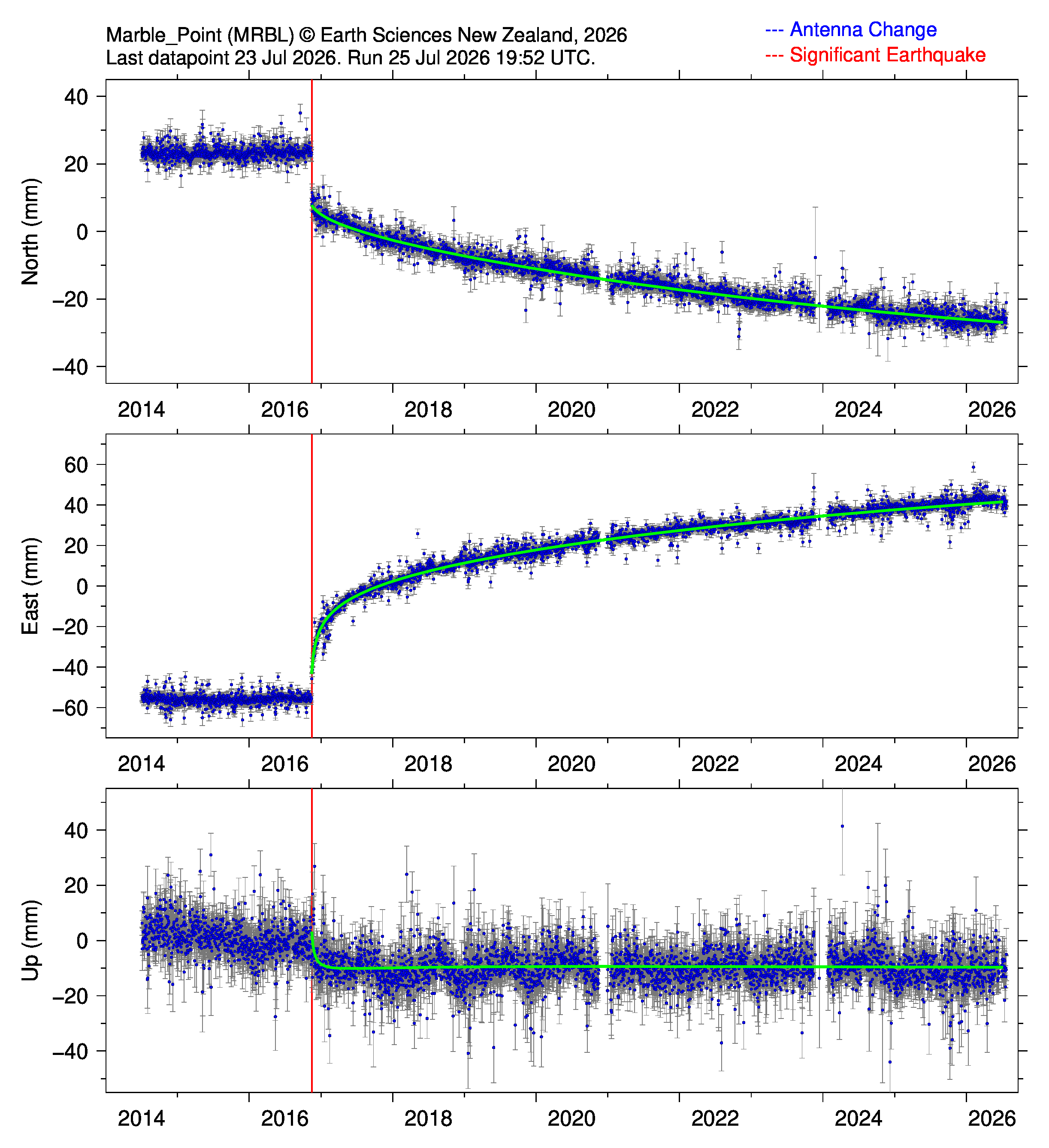
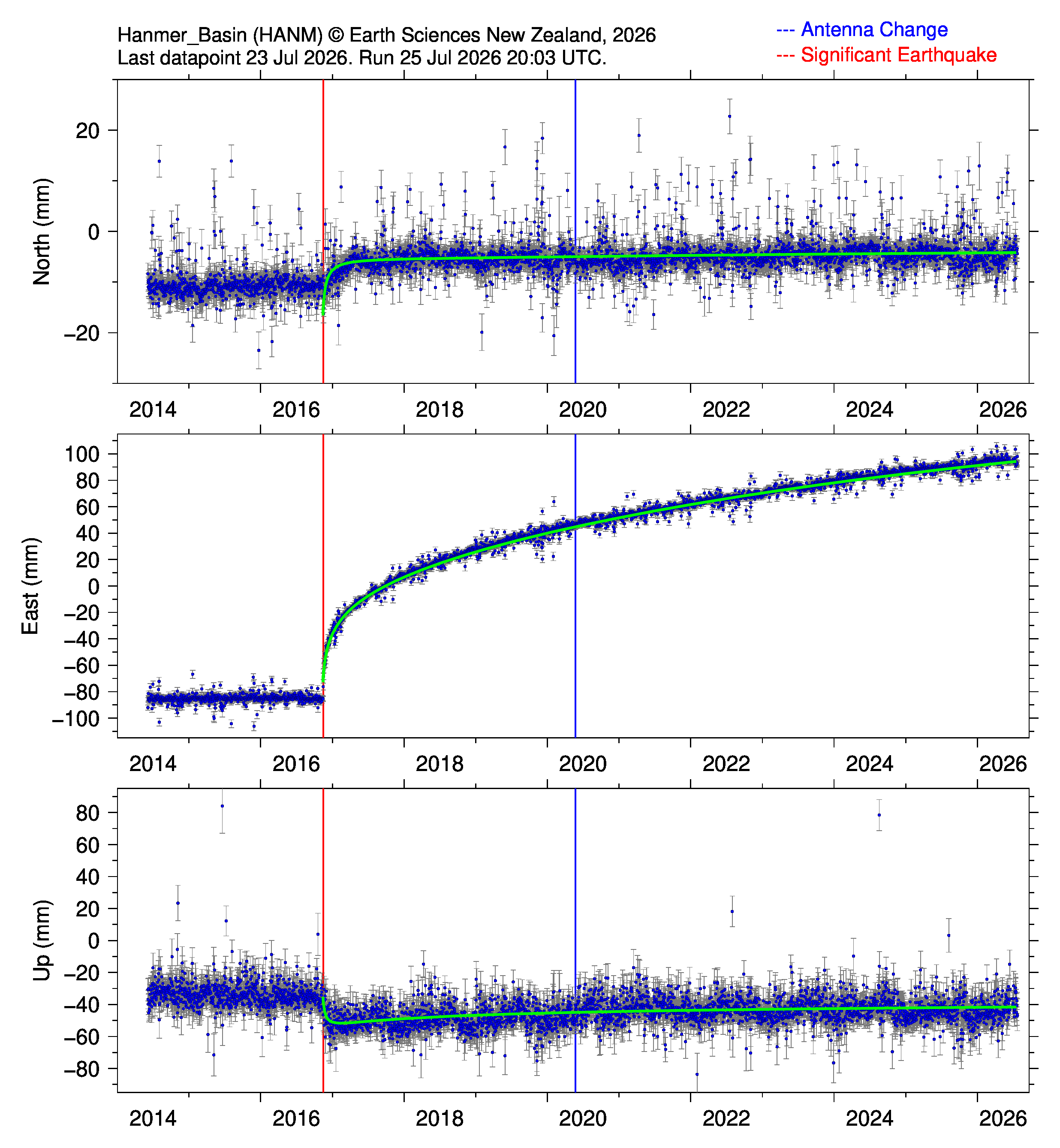
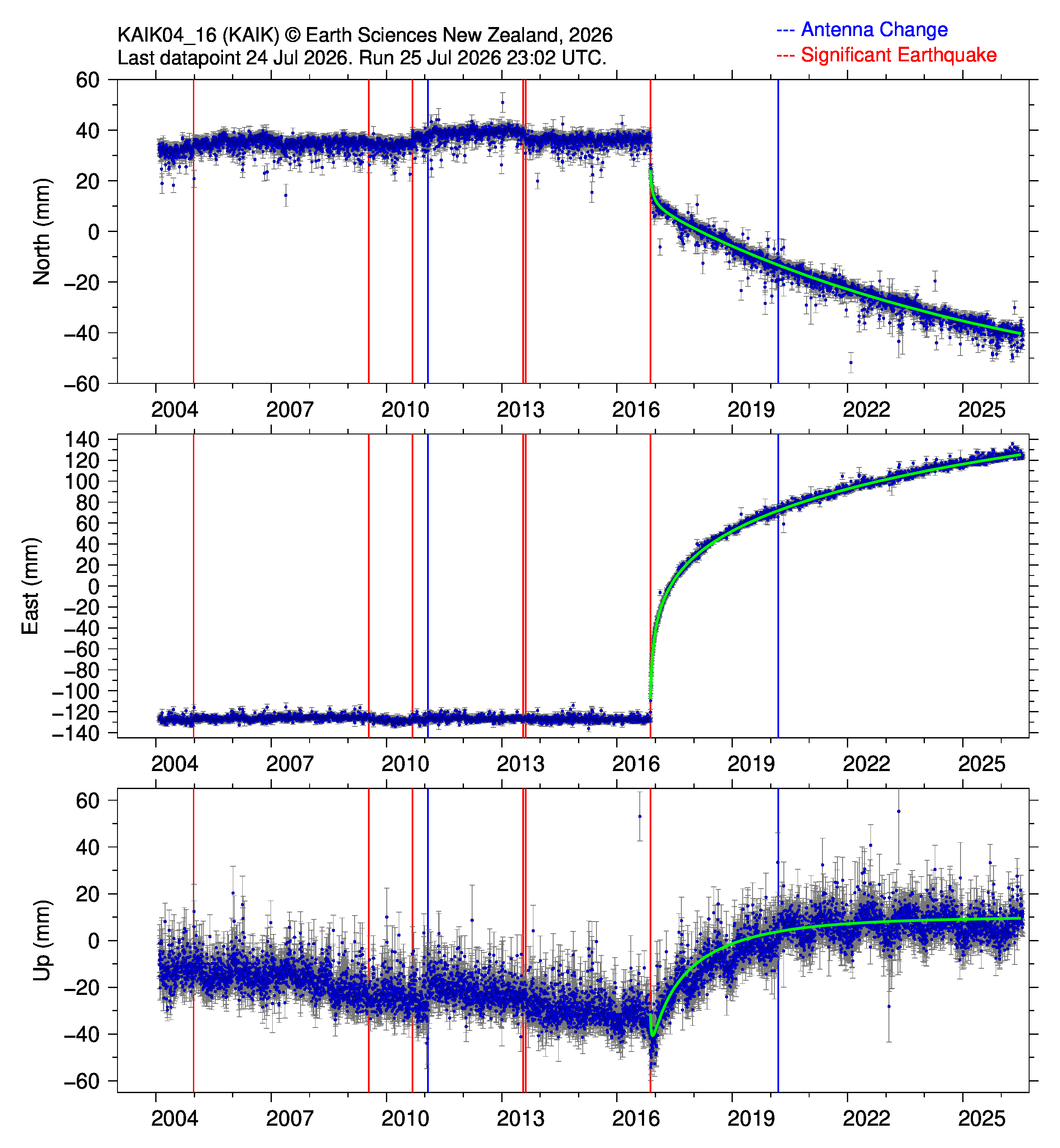
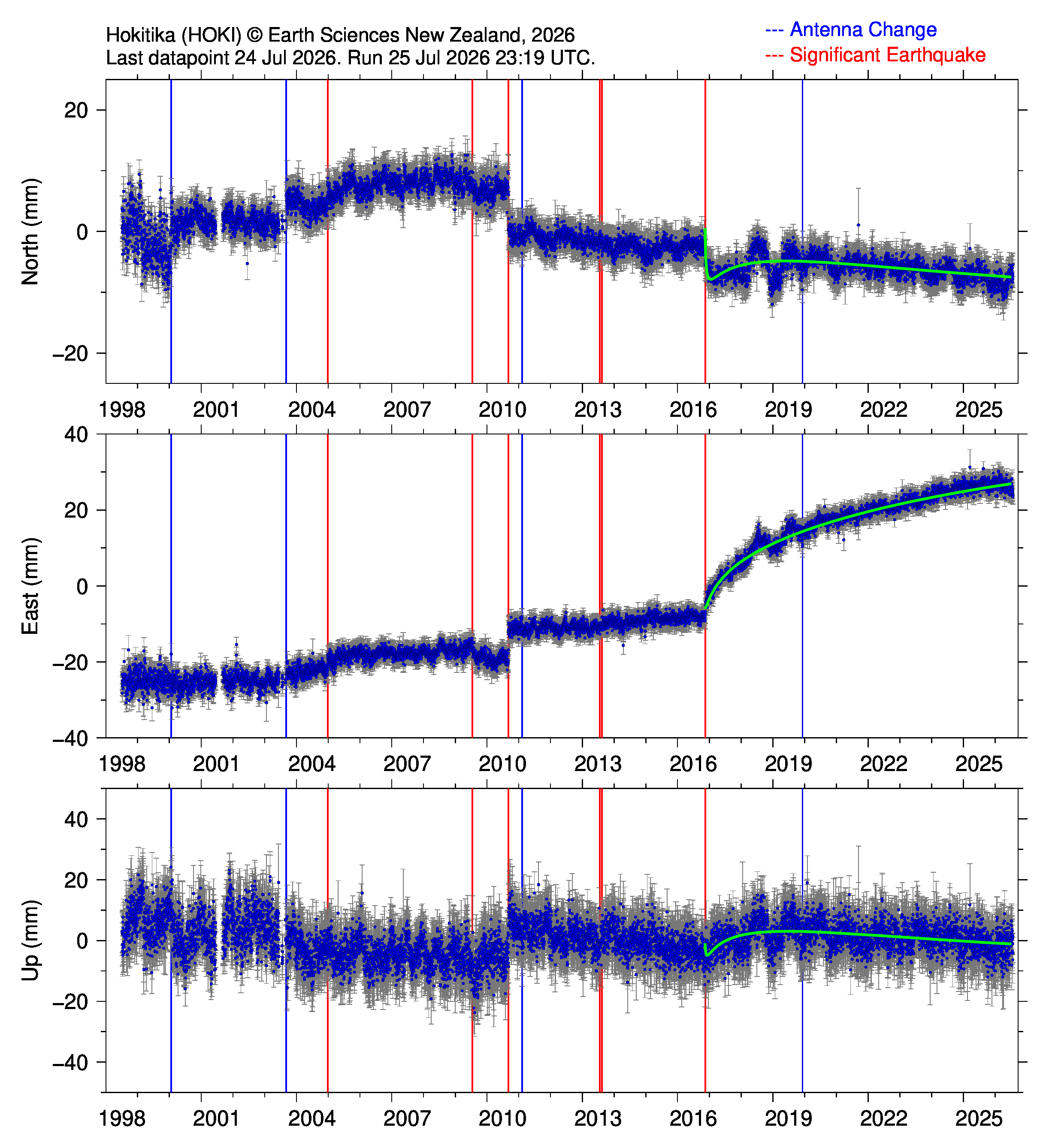
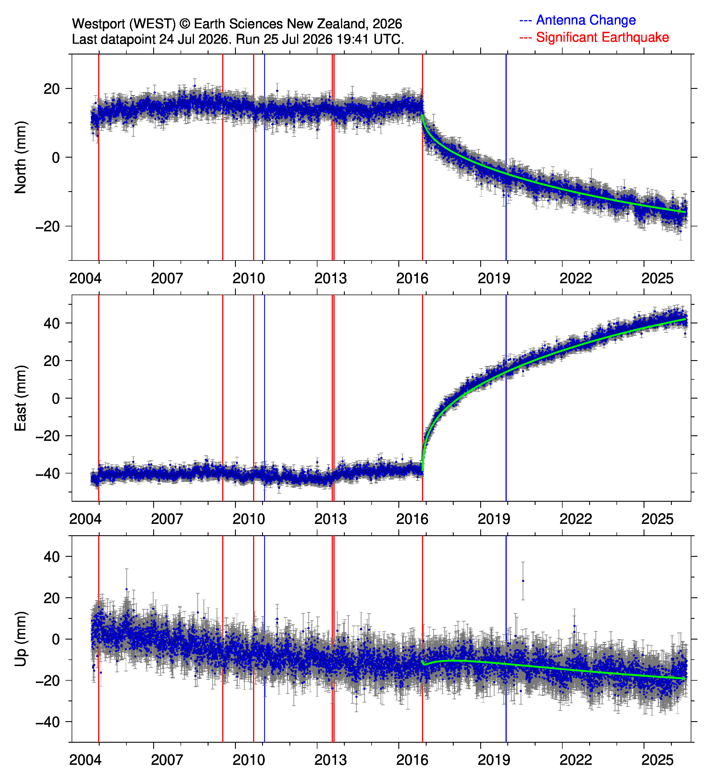
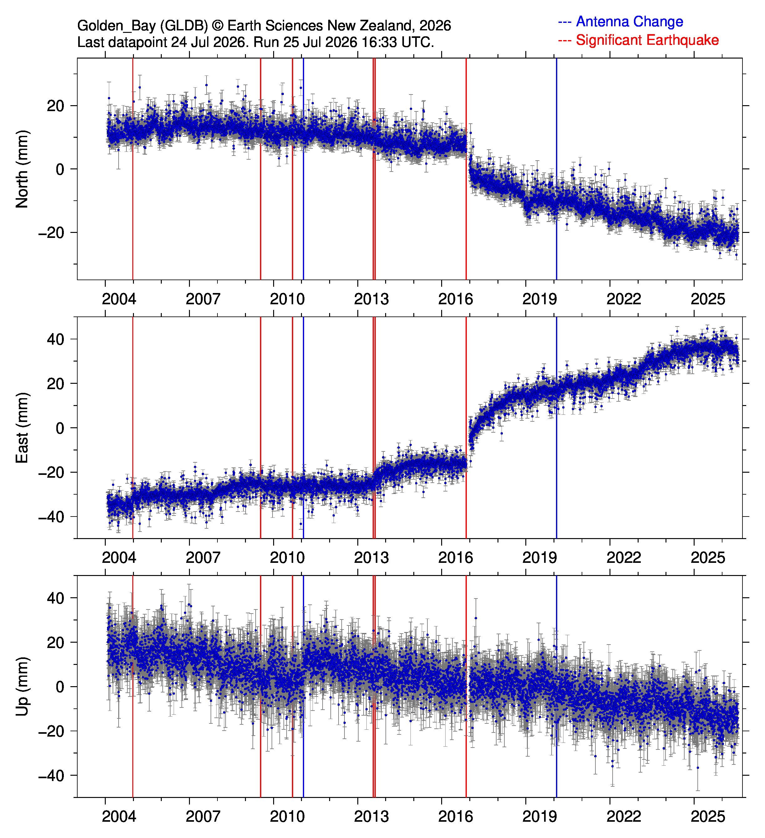
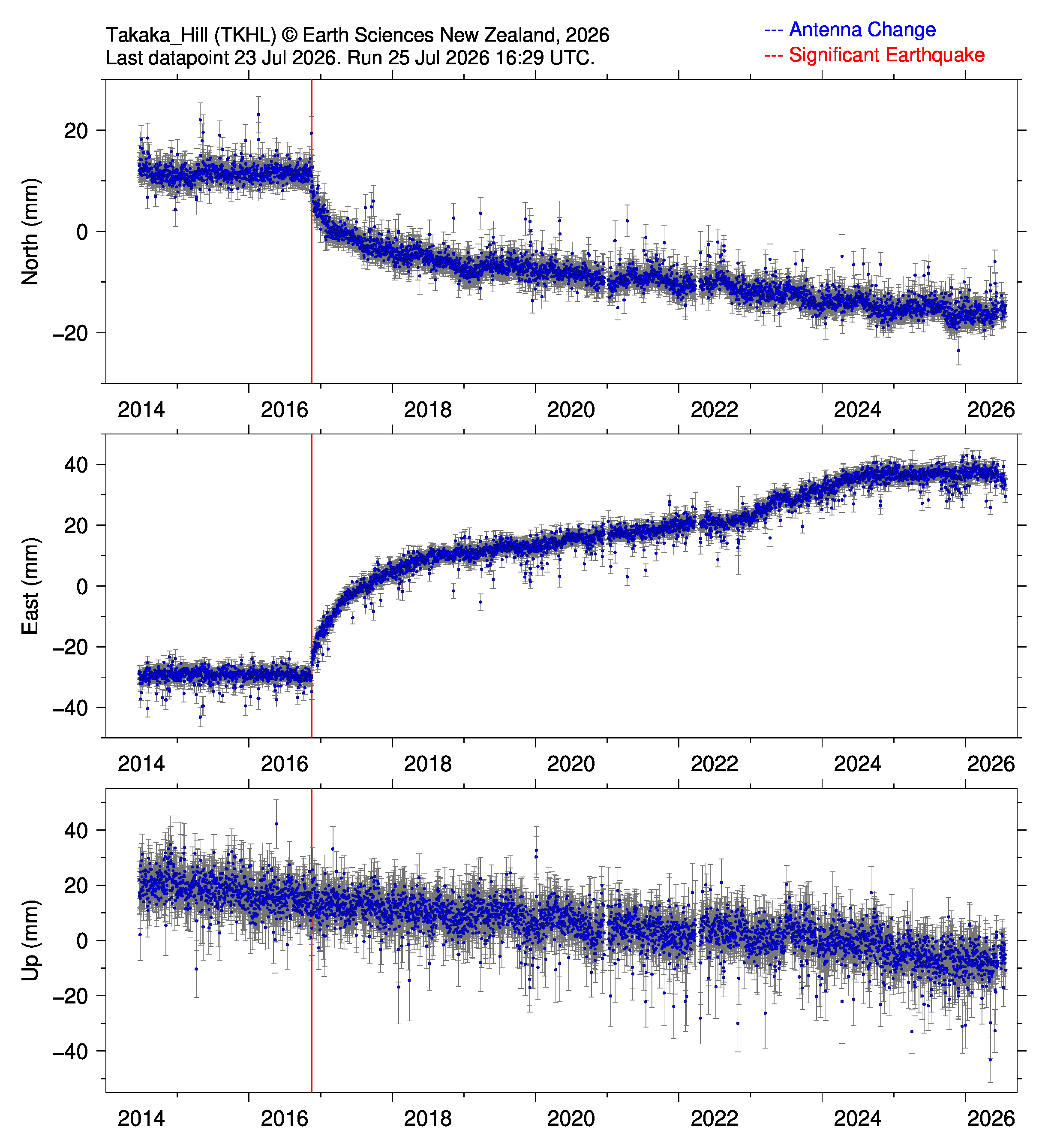
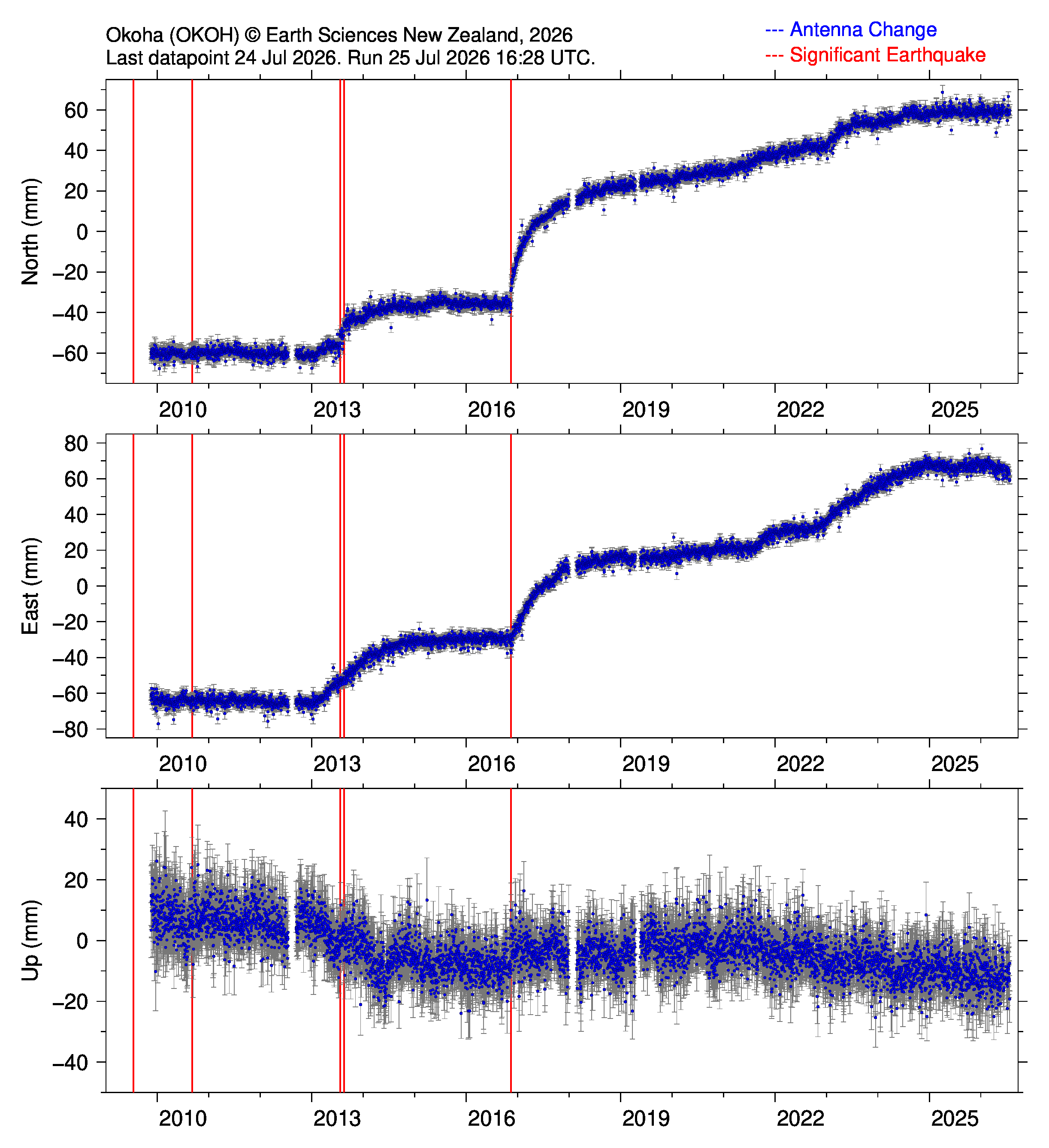
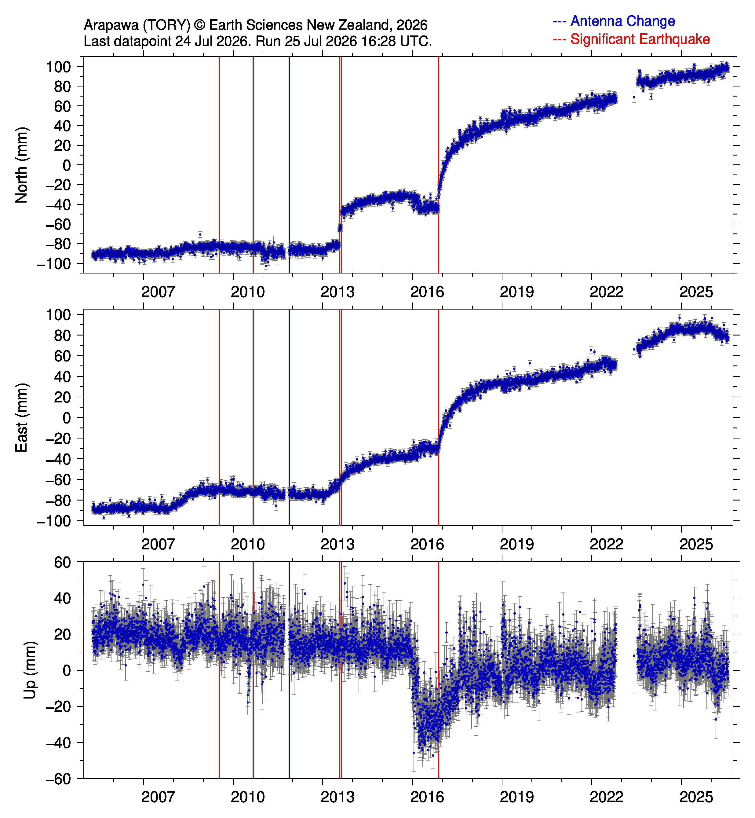
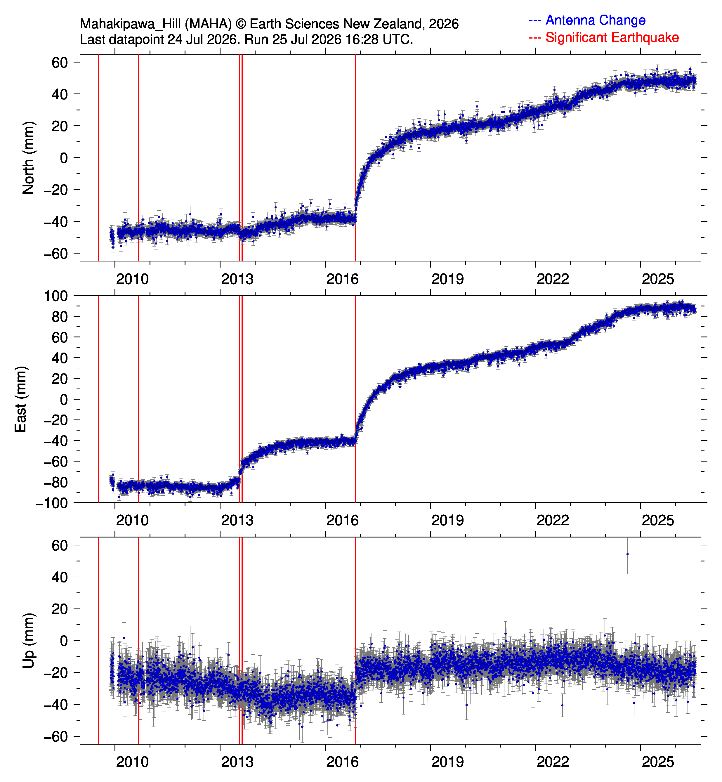
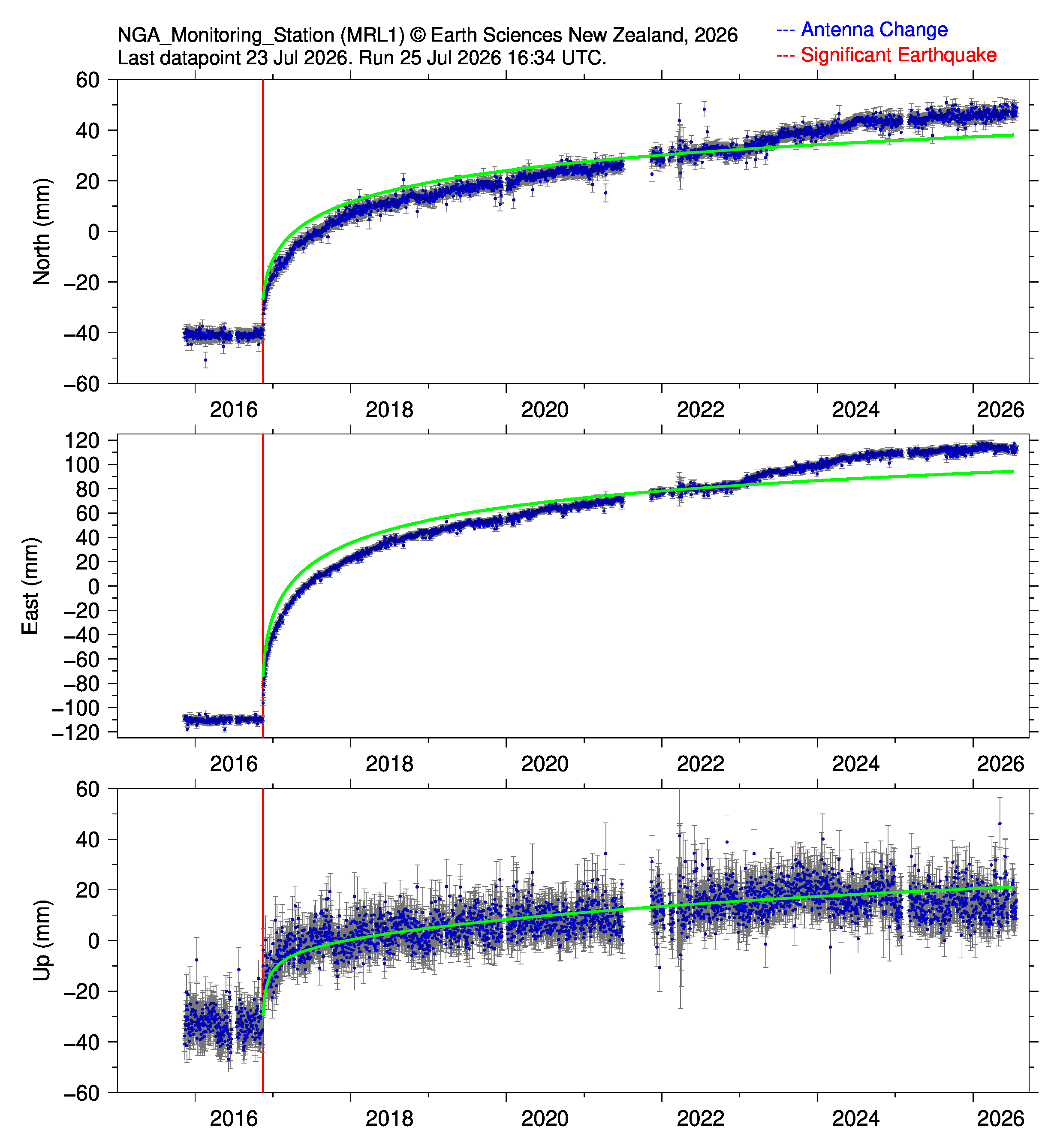
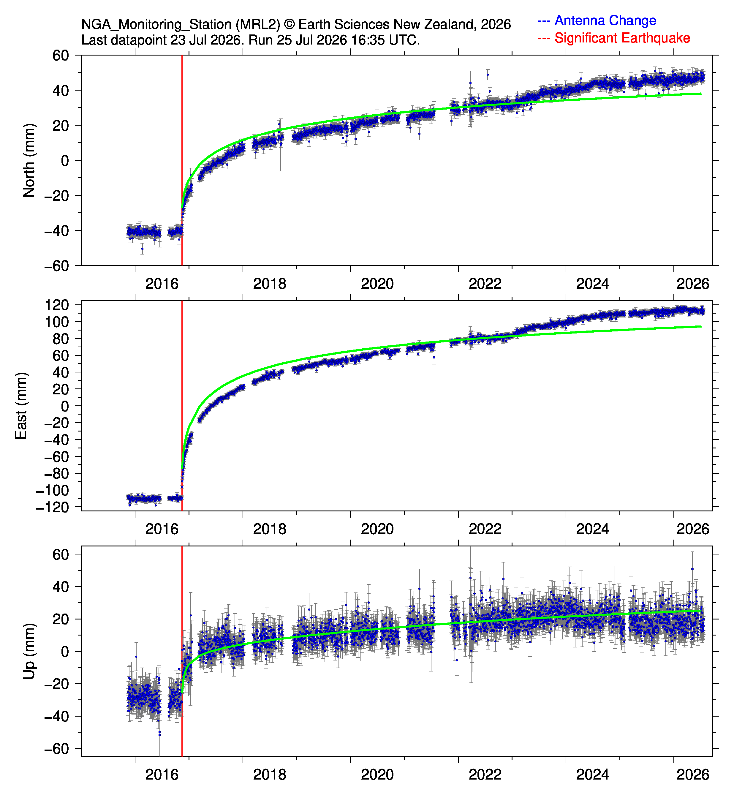
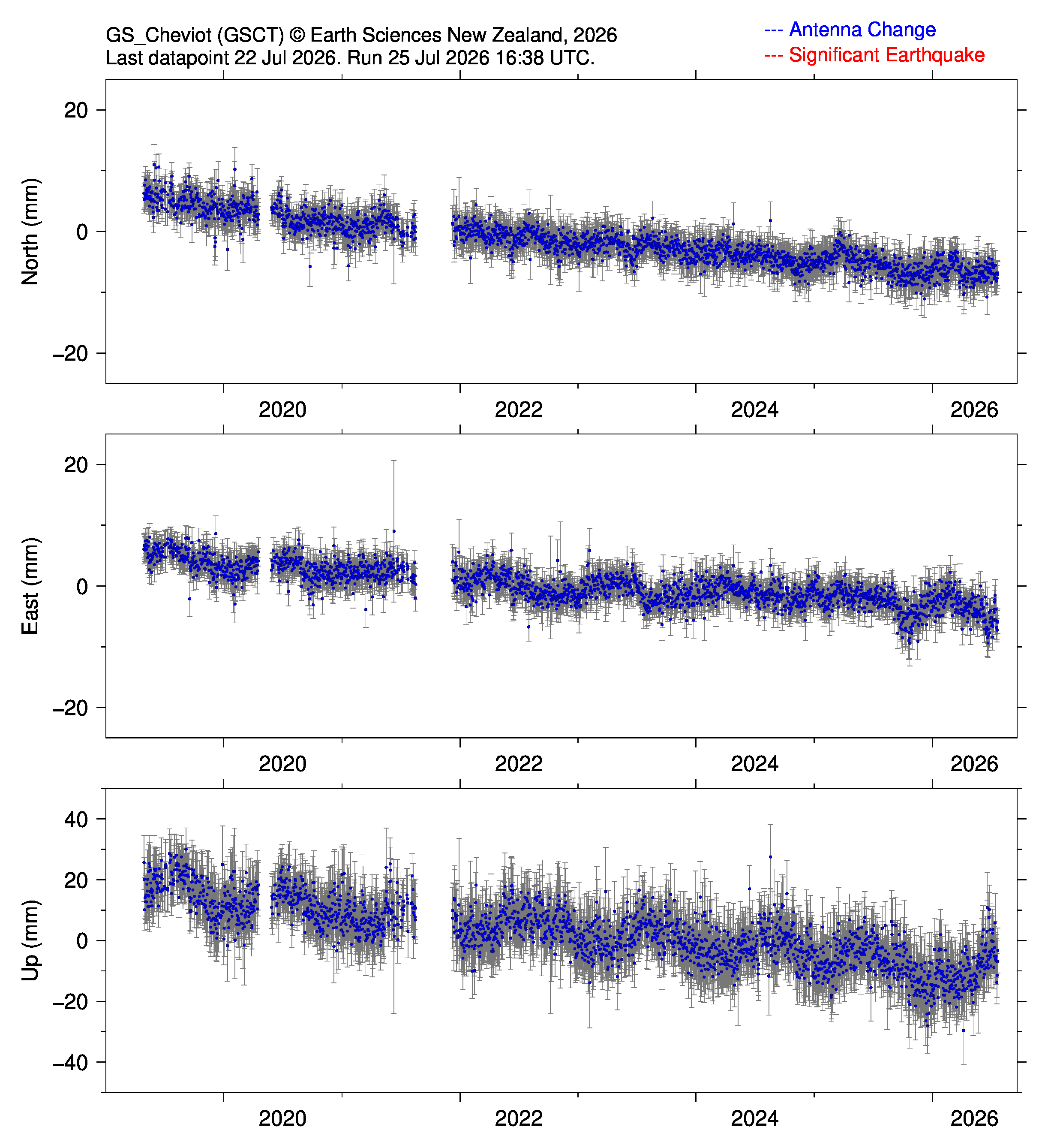
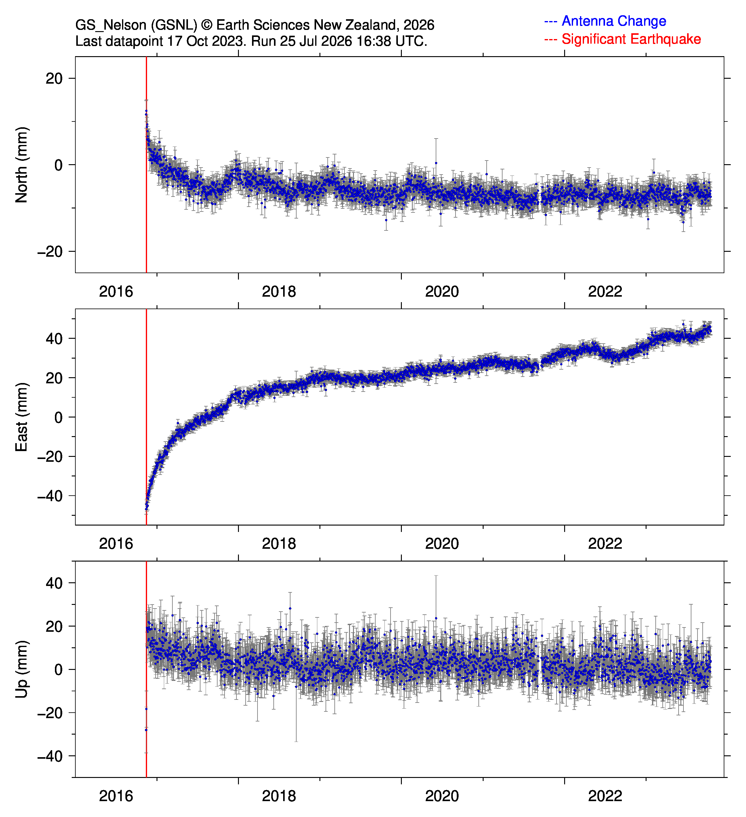
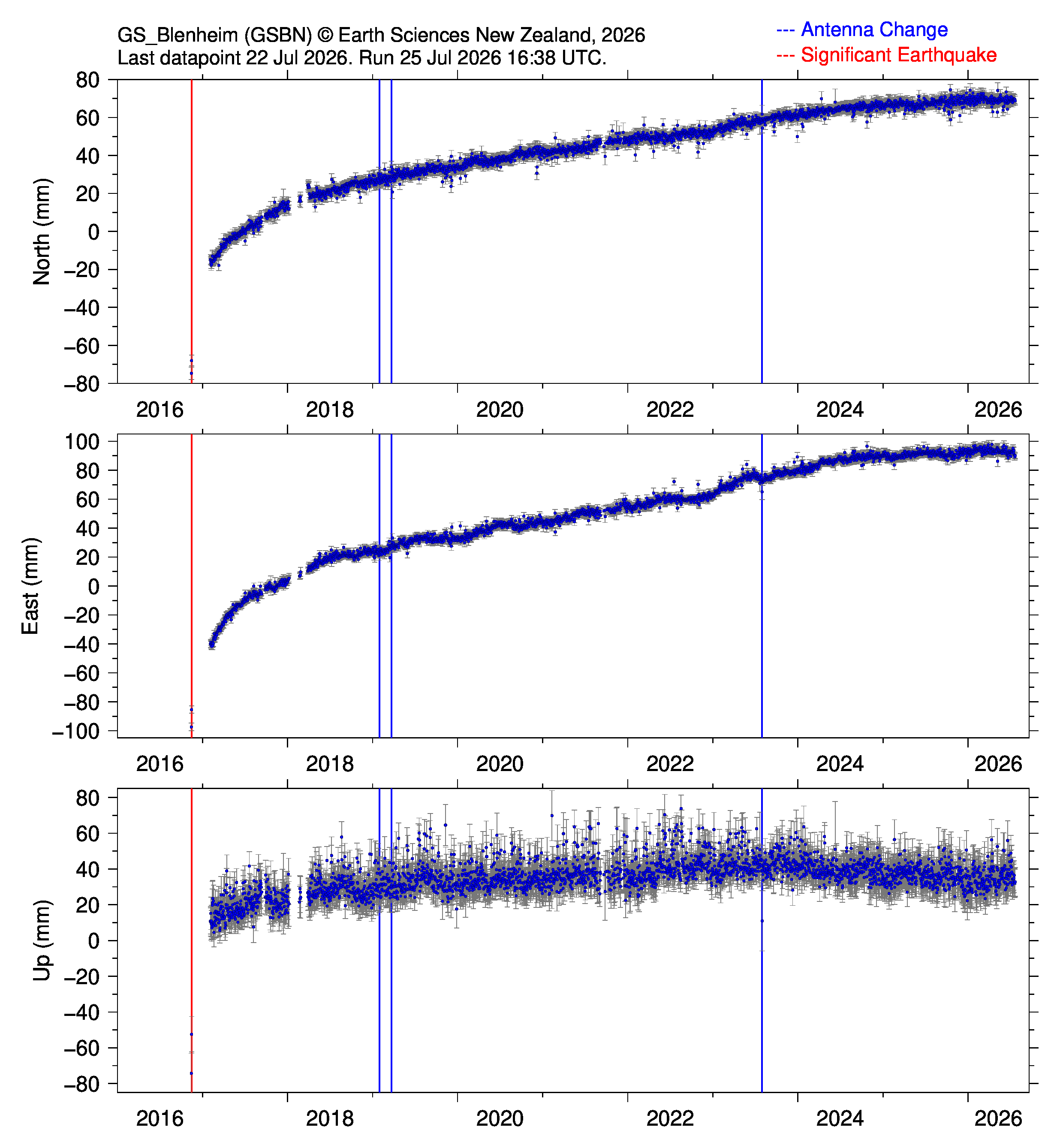
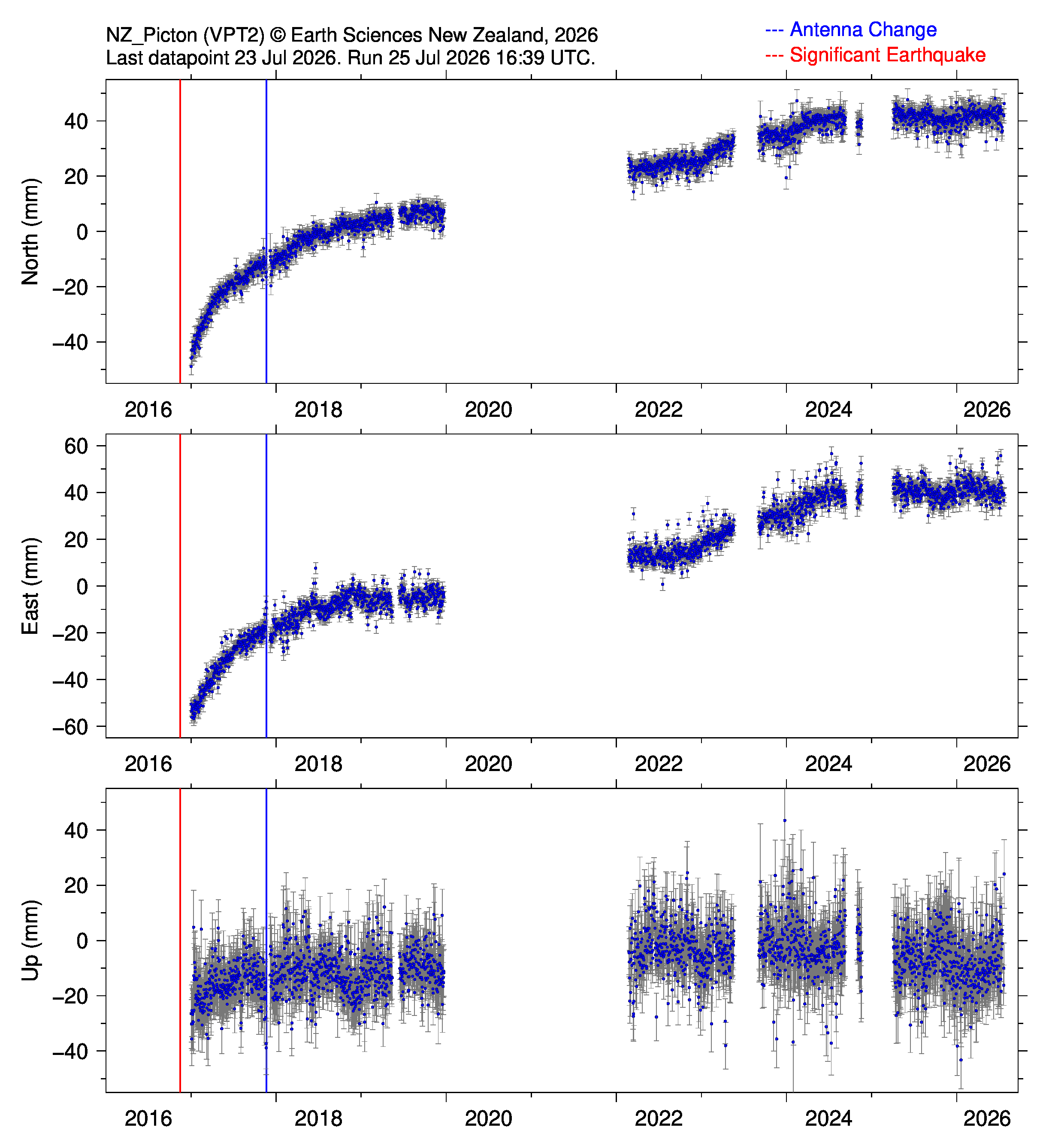
The M7.8 Kaikōura earthquake (2016-11-13 11:02:56 UTC) ruptured multiple faults in the Top of the South Island. These GNSS time series have been corrected for coseismic offsets and the North and East components have been detrended removing linear terms based on pre Kaikōura interseismic deformation field. Green lines show best fit log-log-exp postseismic trend. Figure symbols: Yellow star, epicenter of the Kaikōura earthquake. Blue squares, GeoNet/PositioNZ GNSS stations. Purple circles, semi continuous GNSS stations operated by Earth Sciences New Zealand and Otago University. Red circles, additional stations operated by various surveying firms in NZ.
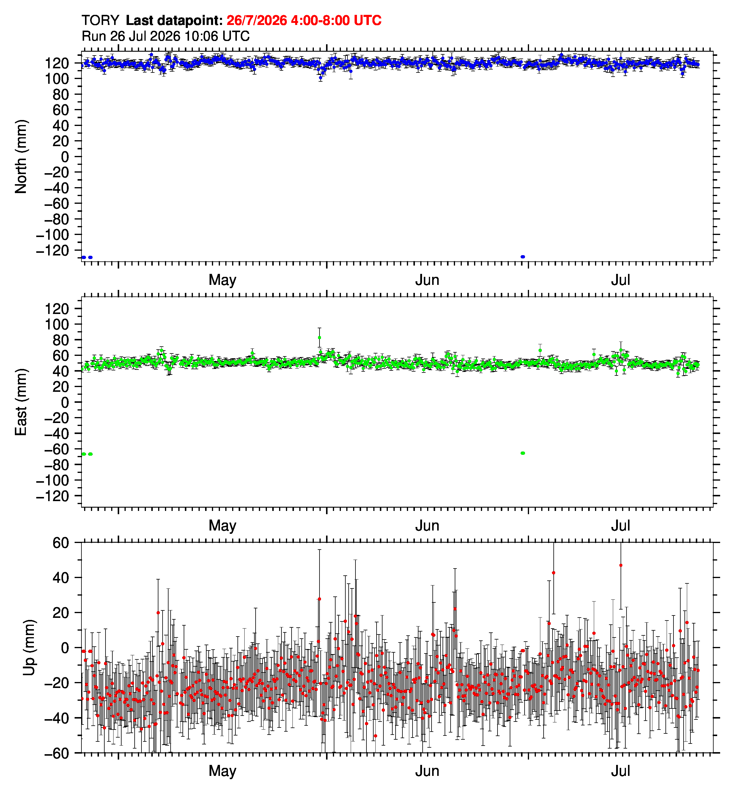
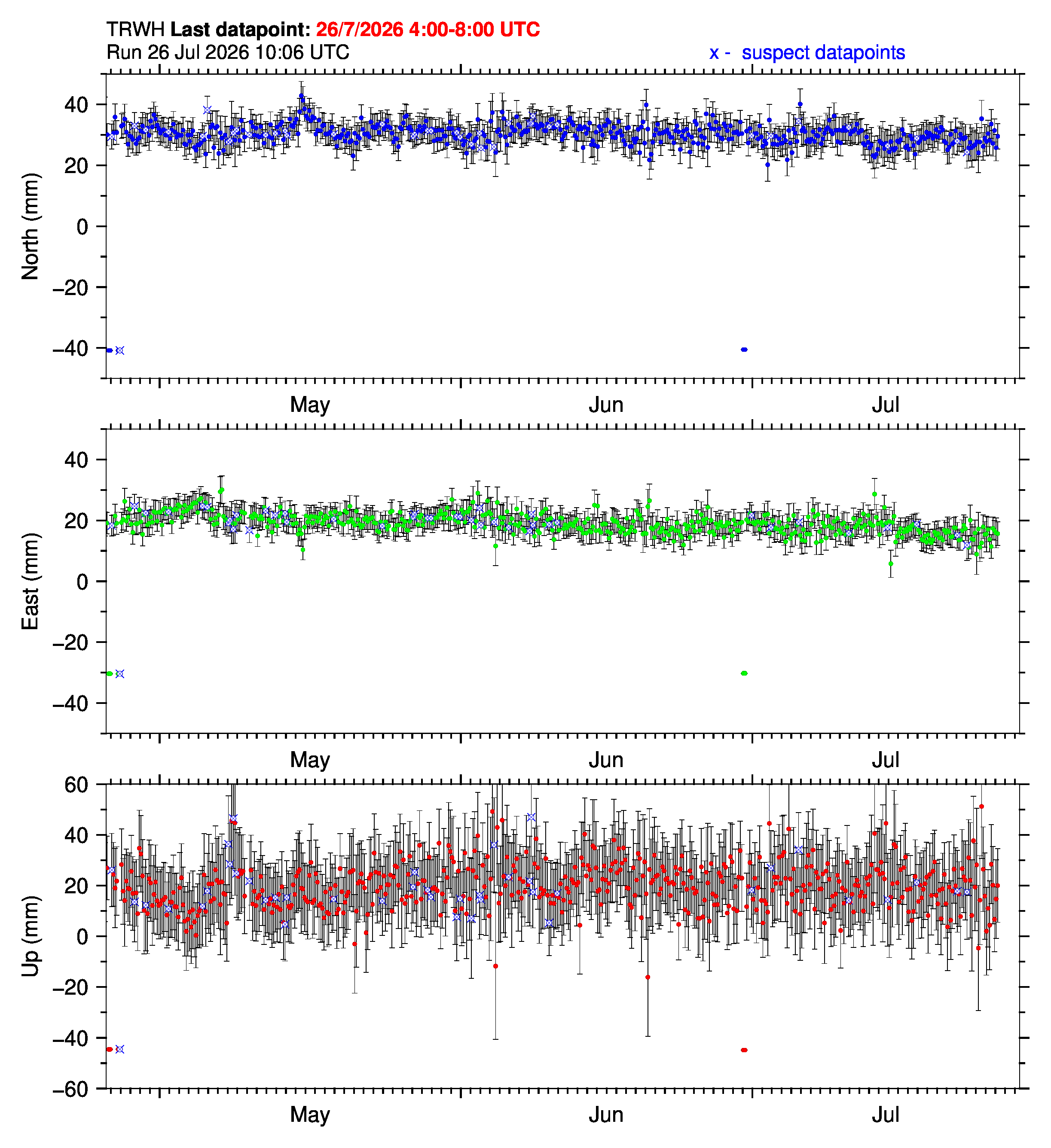
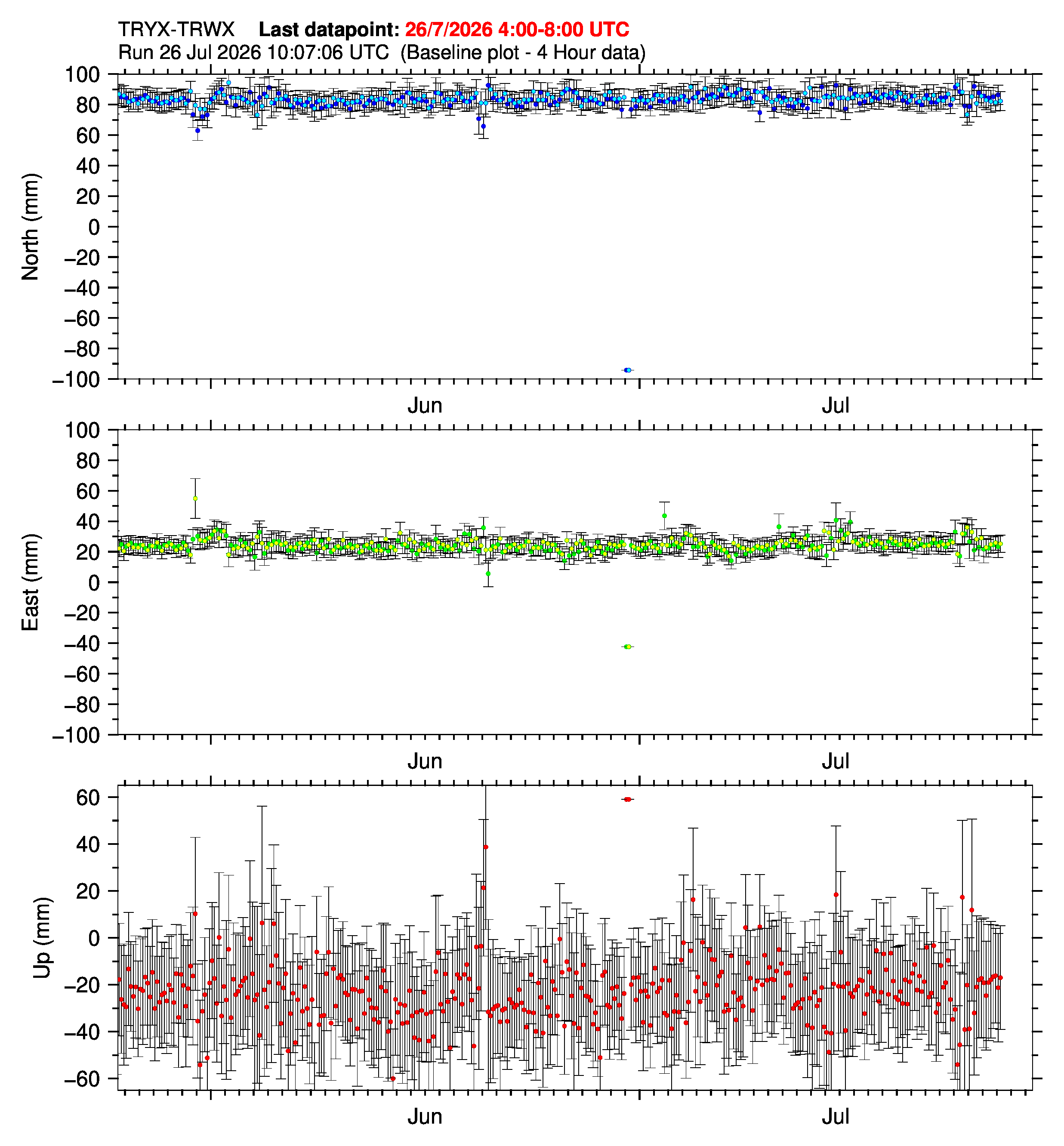
Ultra rapid time series (4 hour):
Tory (TORY): |
Terawhiti (TRWH): |
Baseline TORY-TRWH: |
|
|
|
|

|
GNSS stations operated by Earth Sciences New Zealand (GeoNet/PositioNZ) (24 hour datapoints):
Cape Campbell (CMBL): |
Seddon (SEDD): |
Wither Hills (WITH): |
|
|
|
| |
Lake Tennyson (TEN2+TENN): |
Clarence River (LRR1+CLRR): |
Glen Orkney Station (LOK1+GLOK): |
Wairau Valley (WRA1+WRAU): |
|
|
|
|
Lake Taylor (LKTA): |
Marble Point (MRBL): |
Hanmer Basin (HANM): |
Kaikōura (KAIK): |
|
|
|
|
Hokitika (HOKI): |
Westport (WEST): |
Golden Bay (GLDB): |
Takaka Hill (TKHL): |
|
|
|
|
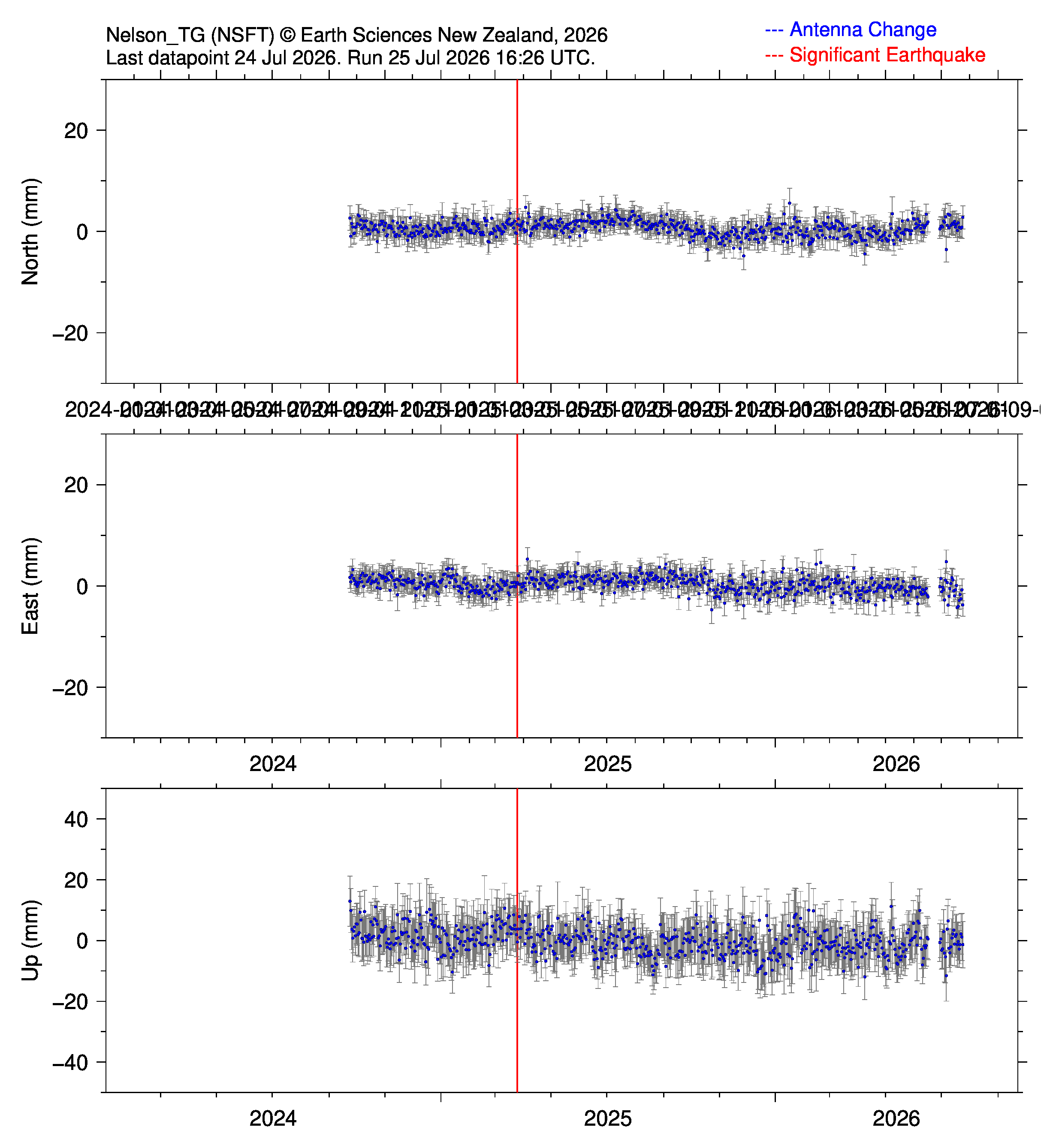
Nelson Tide Gauge (NSFT): |
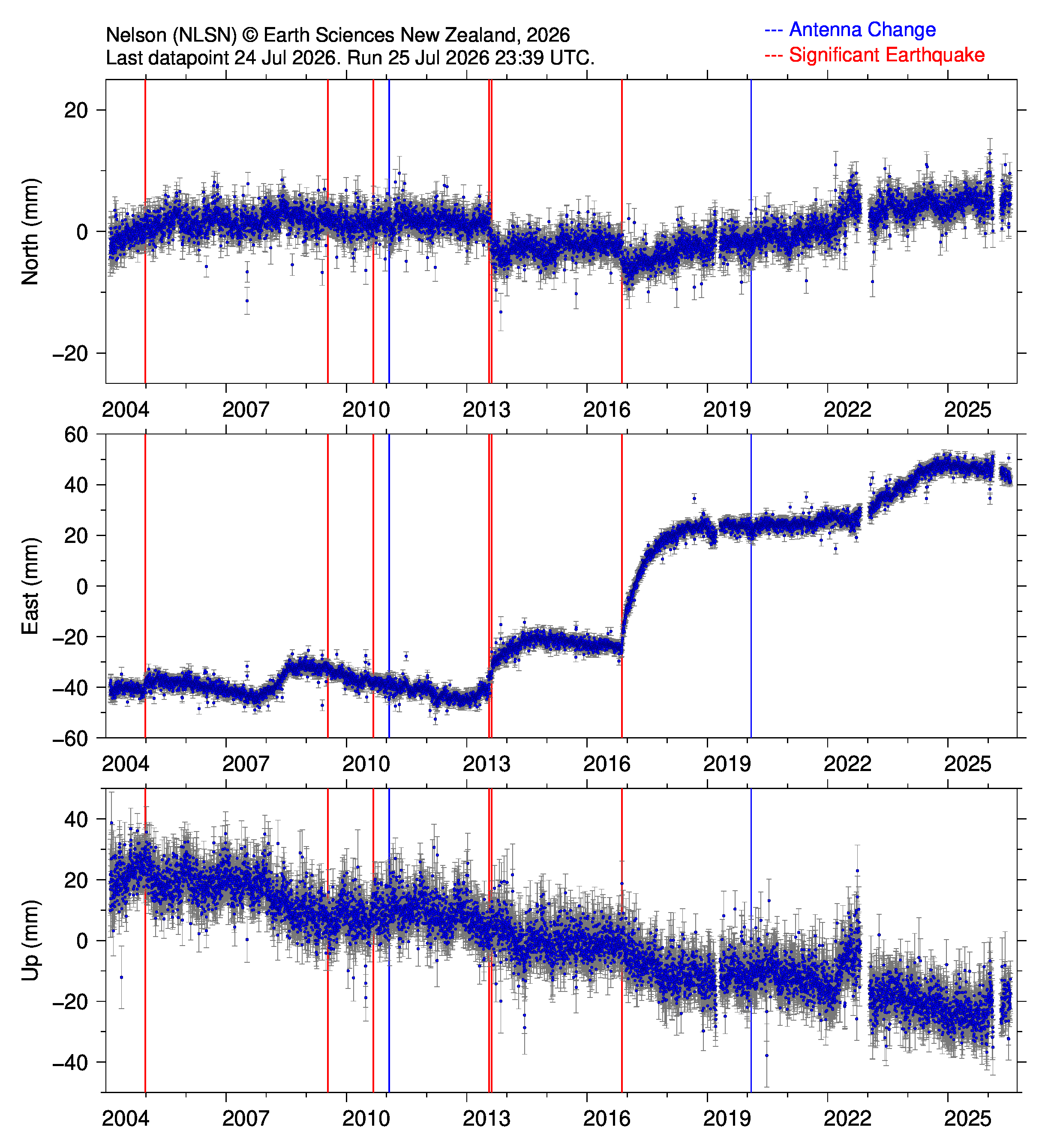
Nelson (NLSN) |
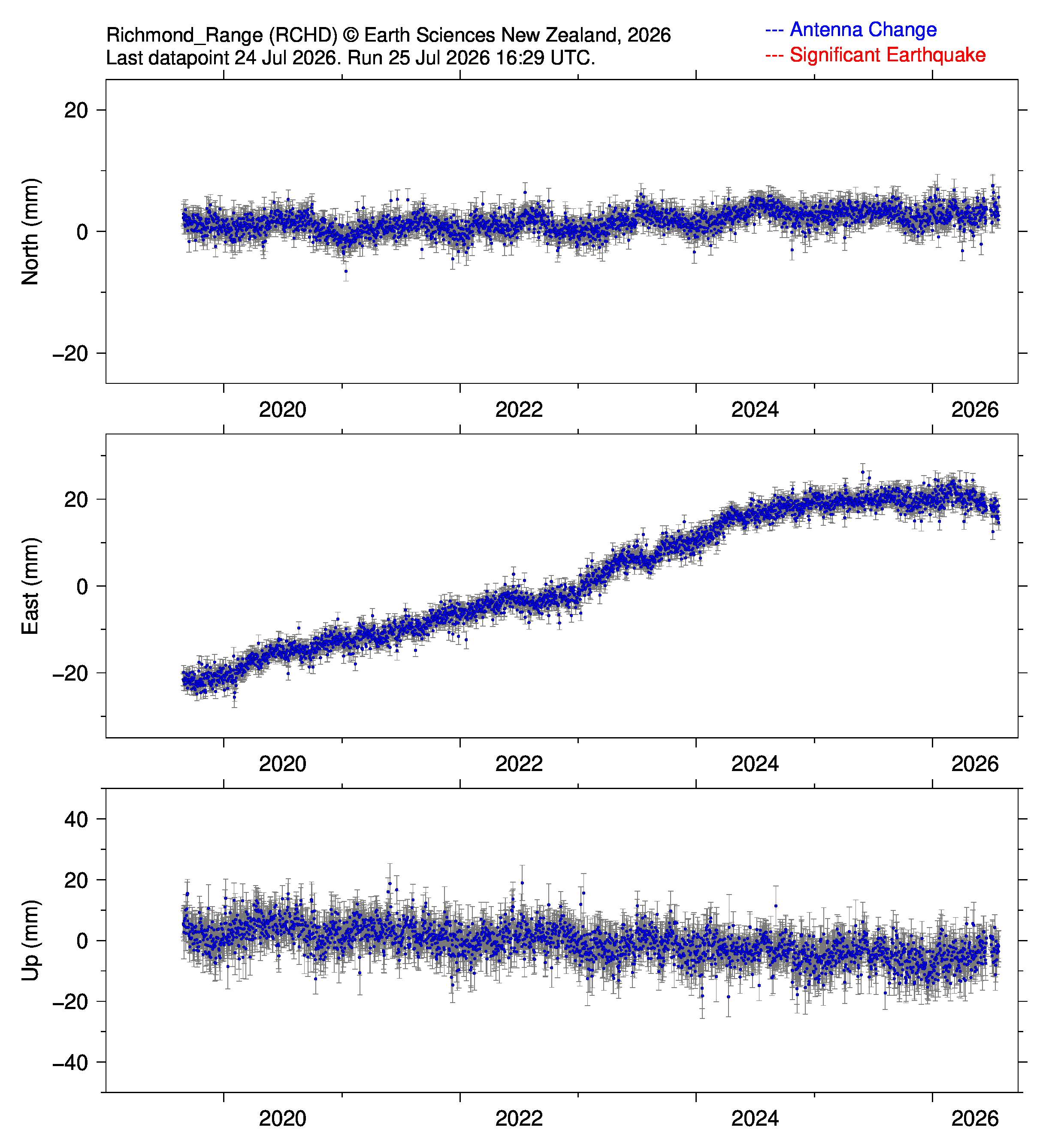
Richmond Range (RCHD): | |
|
|
| |
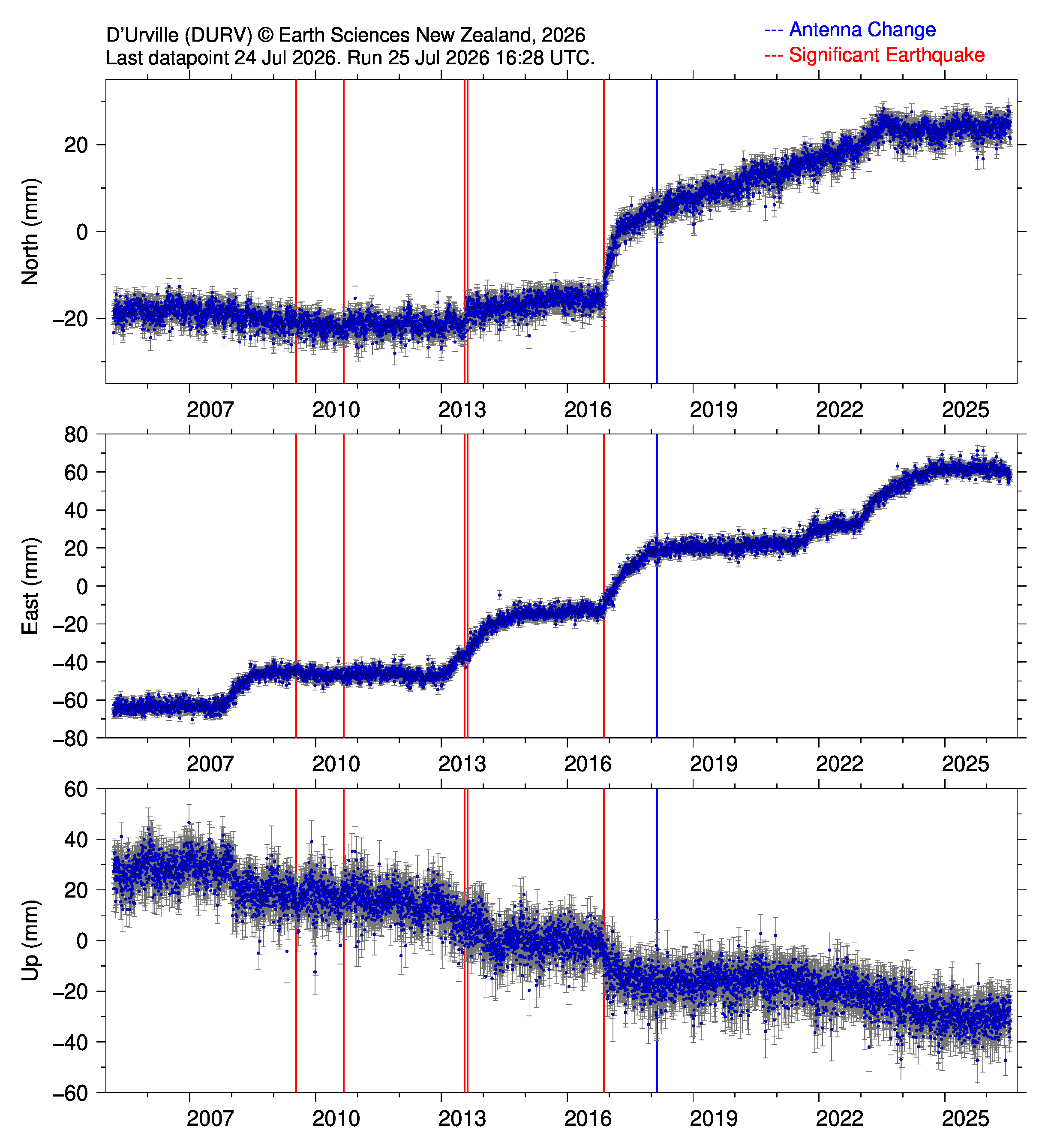
D'Urville (DURV): |
Okoha (OKOH): |
Arapawa No2 (TORY): |
Mahakipawa Hill (MAHA): |
|
|
|
|
GNSS station operated by the National Geospatial-Intelligence Agency (NGA) (24 hour datapoints):
Marlborough 1 (MRL1): |
Marlborough 2 (MRL2): |
|
|
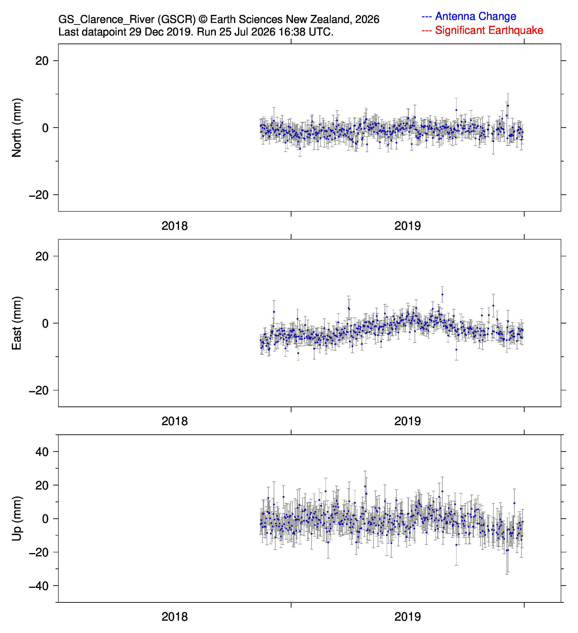
GNSS stations operated by Global Survey (GS) (24 hour datapoints):
GS Cheviot (GSCT): |
GS Nelson (GSNL): |
GS Blenheim (GSBN): |
GS Clarence River (GSCR): |
|
|
|
|
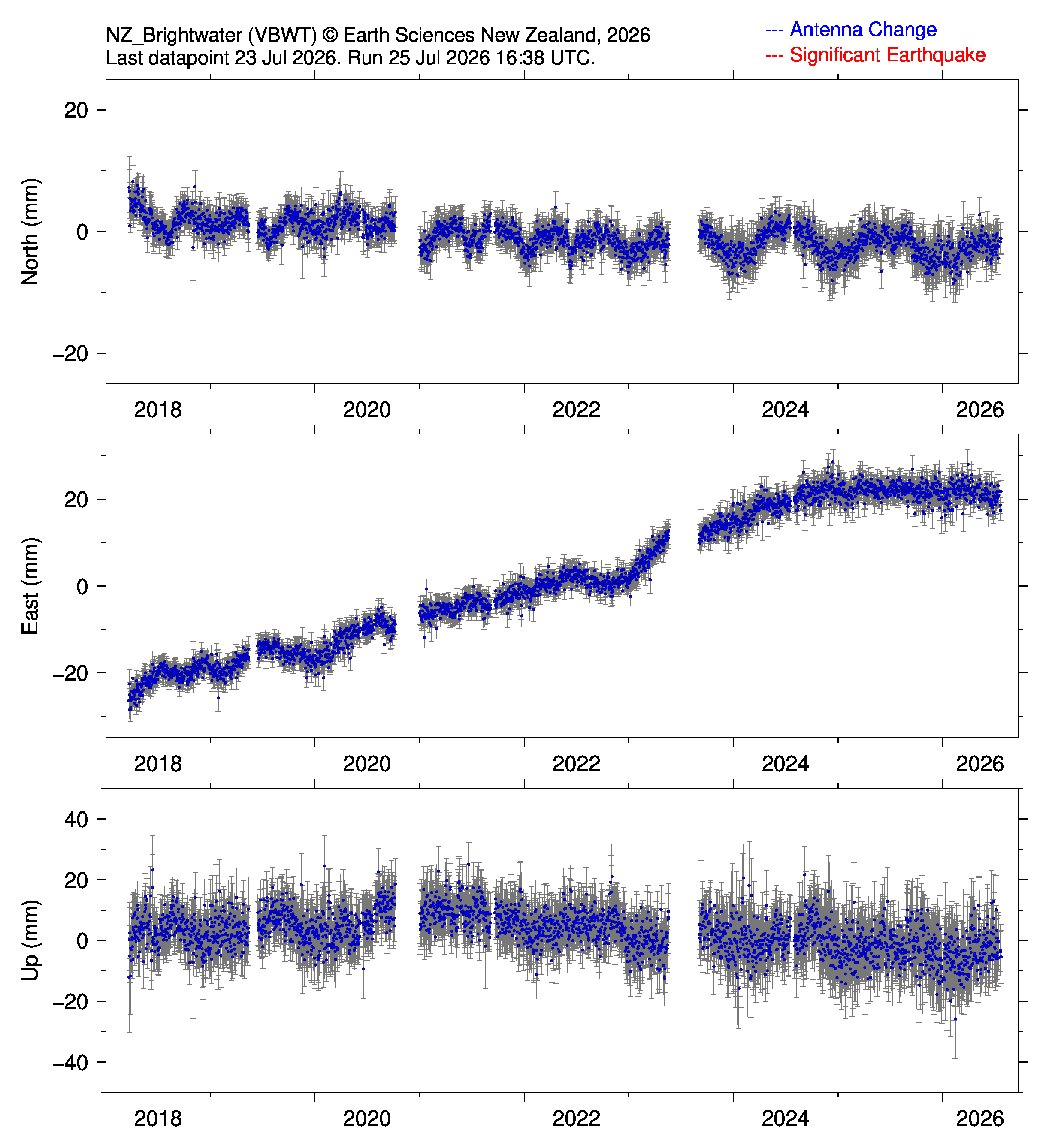
GNSS tations operated by AllTerra/Trimble (24 hour datapoints):
Brightwater (VBWT): |
Picton (VPCT/VPT2): |
|
|
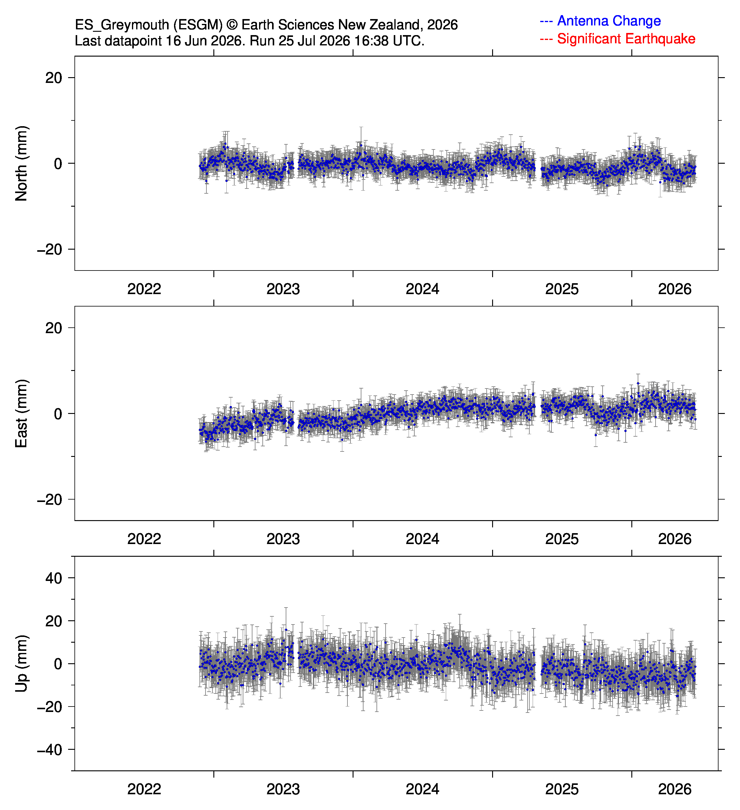
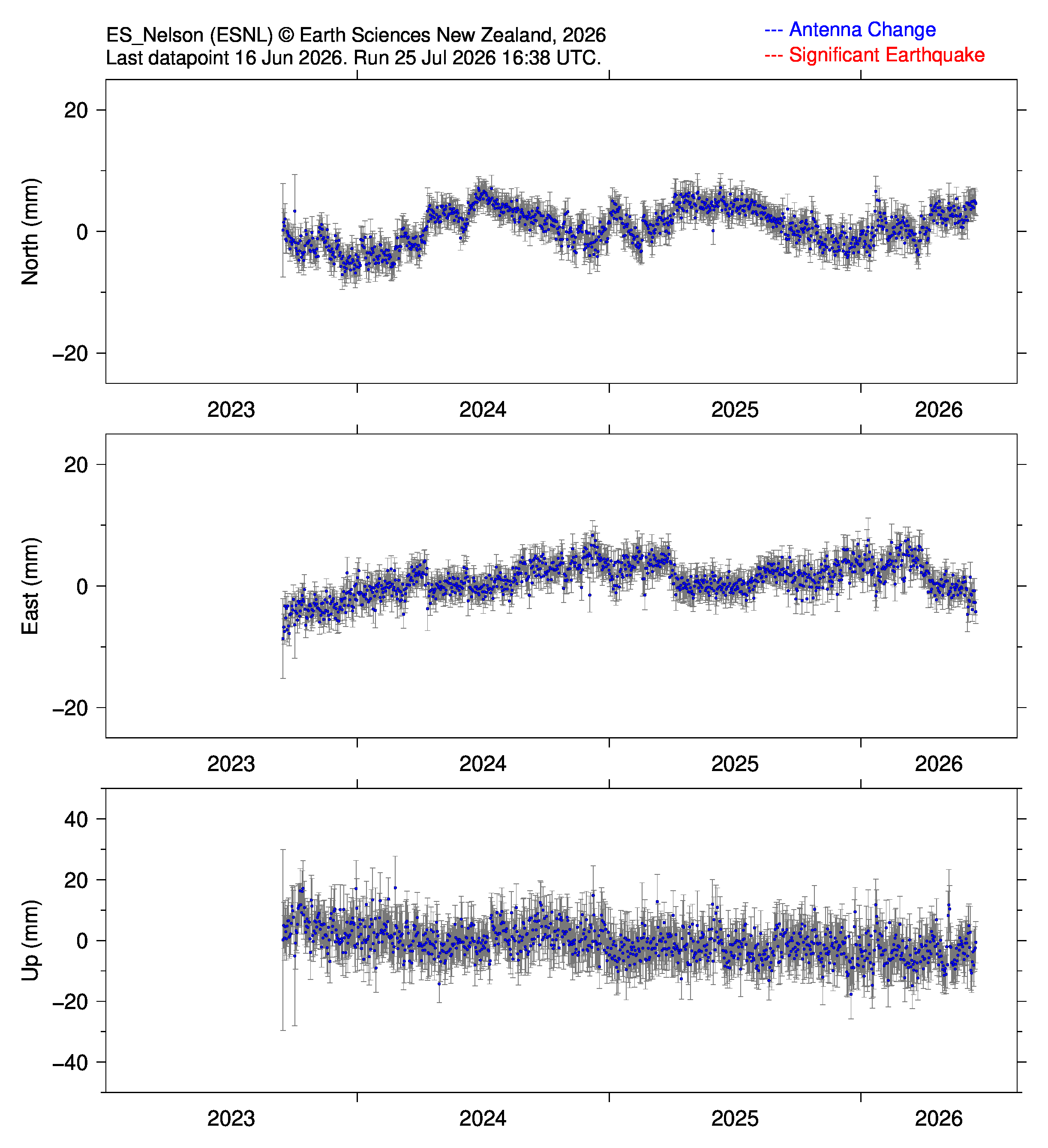
GNSS stations operated by Eliot Sinclair and Partners Ltd (ES) (24 hour datapoints):
ES Greymouth (ESGM): |
ES Nelson (ESNL): |
|
|
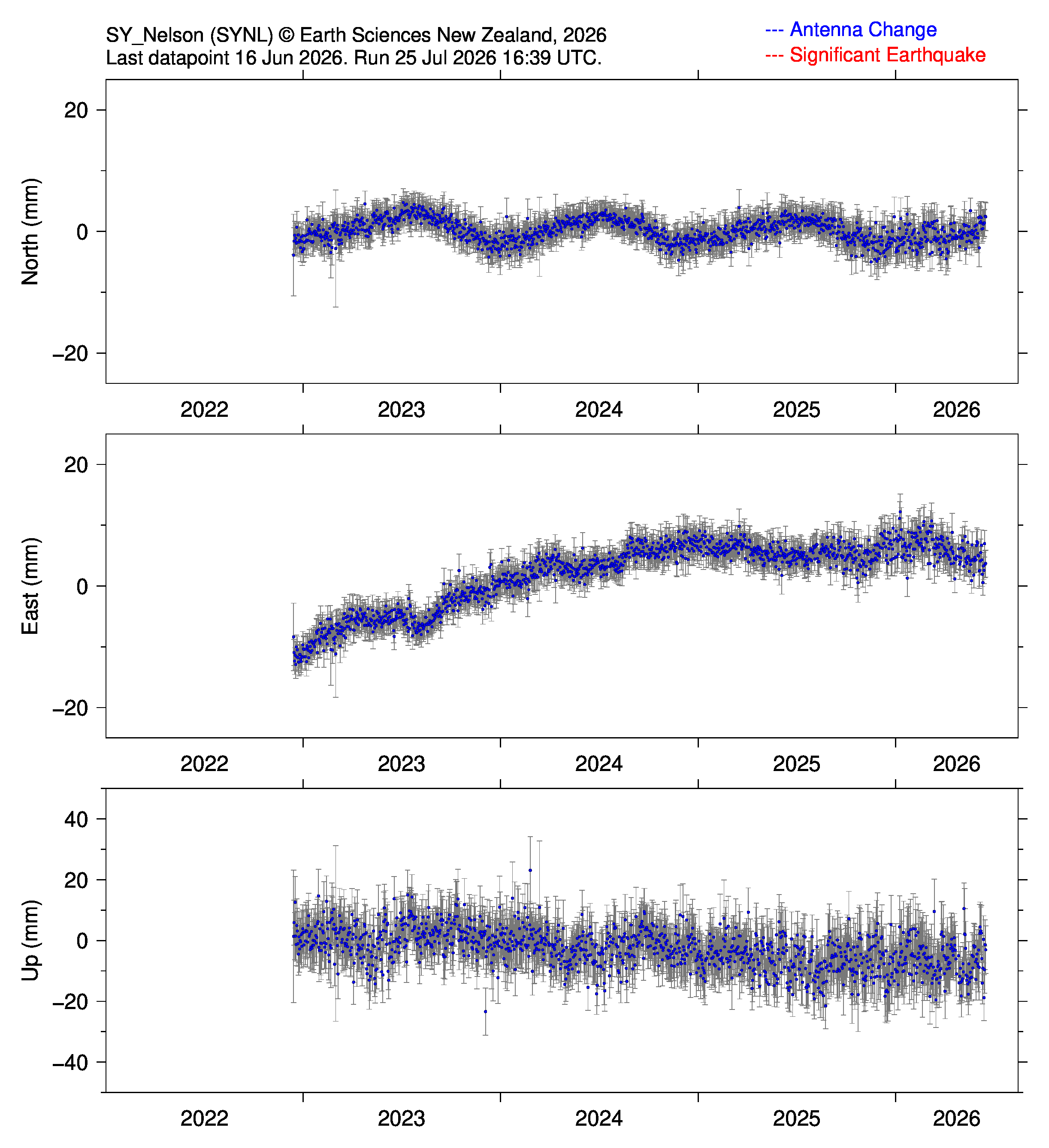
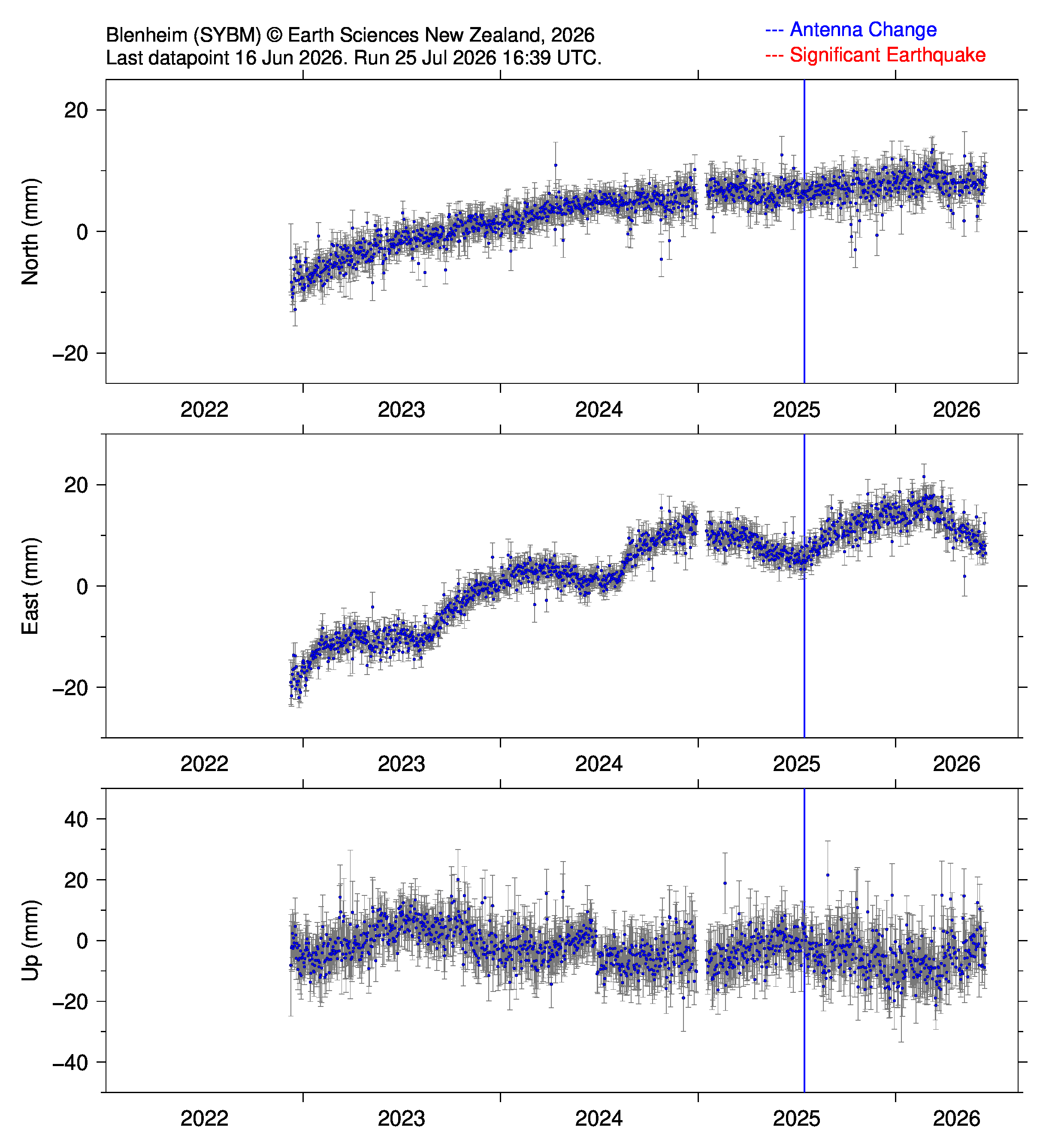
GNSS stations operated by Aptella (24 hour datapoints):
Nelson (SYNL): |
Blenheim (SYBM): |
|
|